Capitol (with an o)
Visiting Utah National Parks and Monuments from east to west, Arches to Zion (end of May). The parks are monumental with extraordinary discoveries in between.
See Monument Valley Link – click here
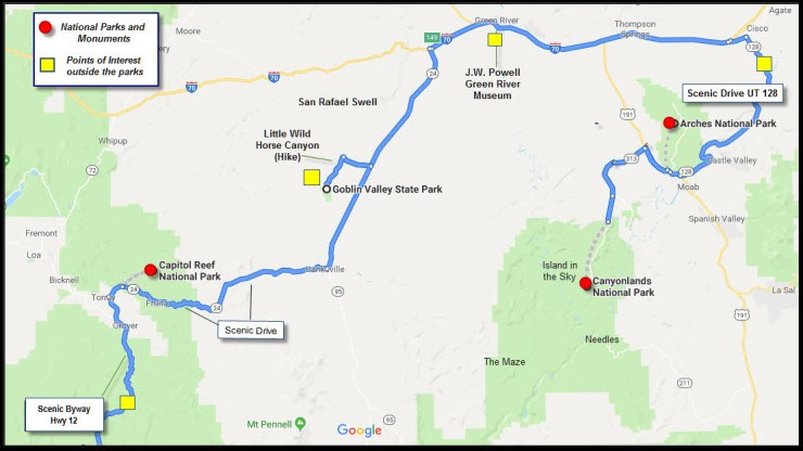
Arches, Canyonlands, Capitol Reef 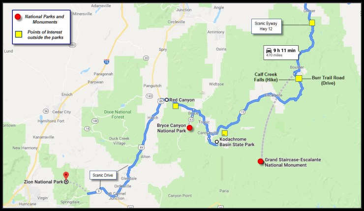
Grand Staircase, Bryce;, Zion
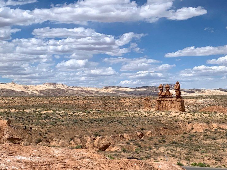
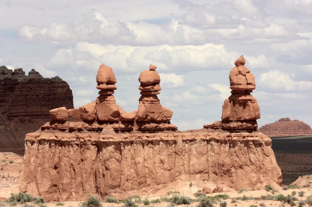
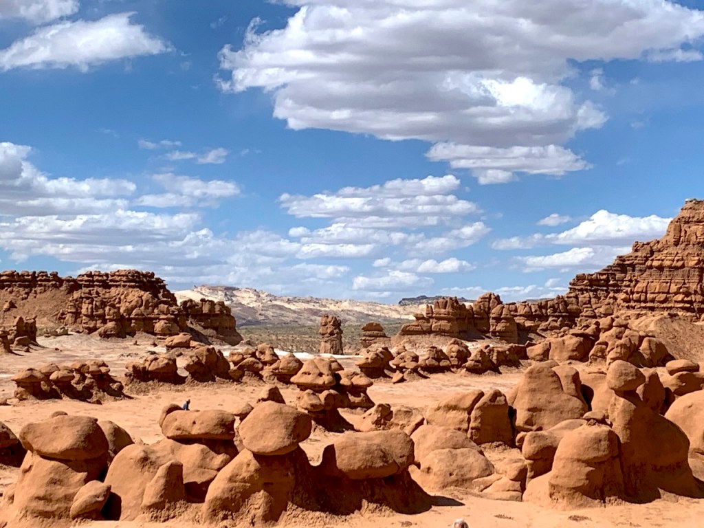
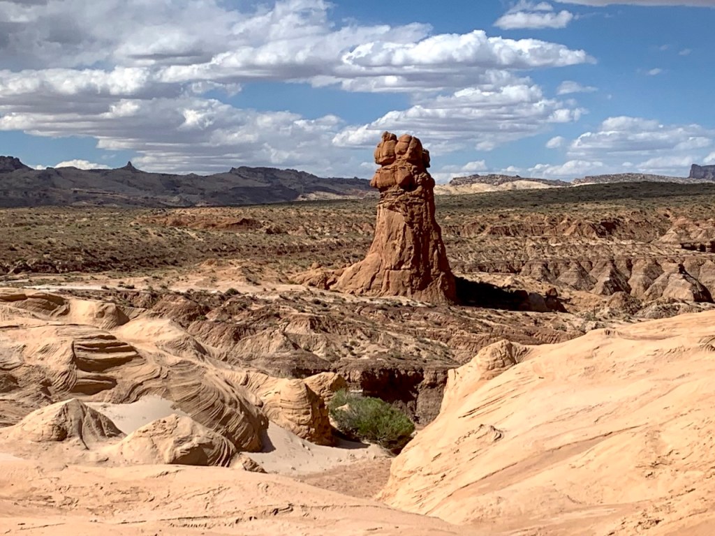
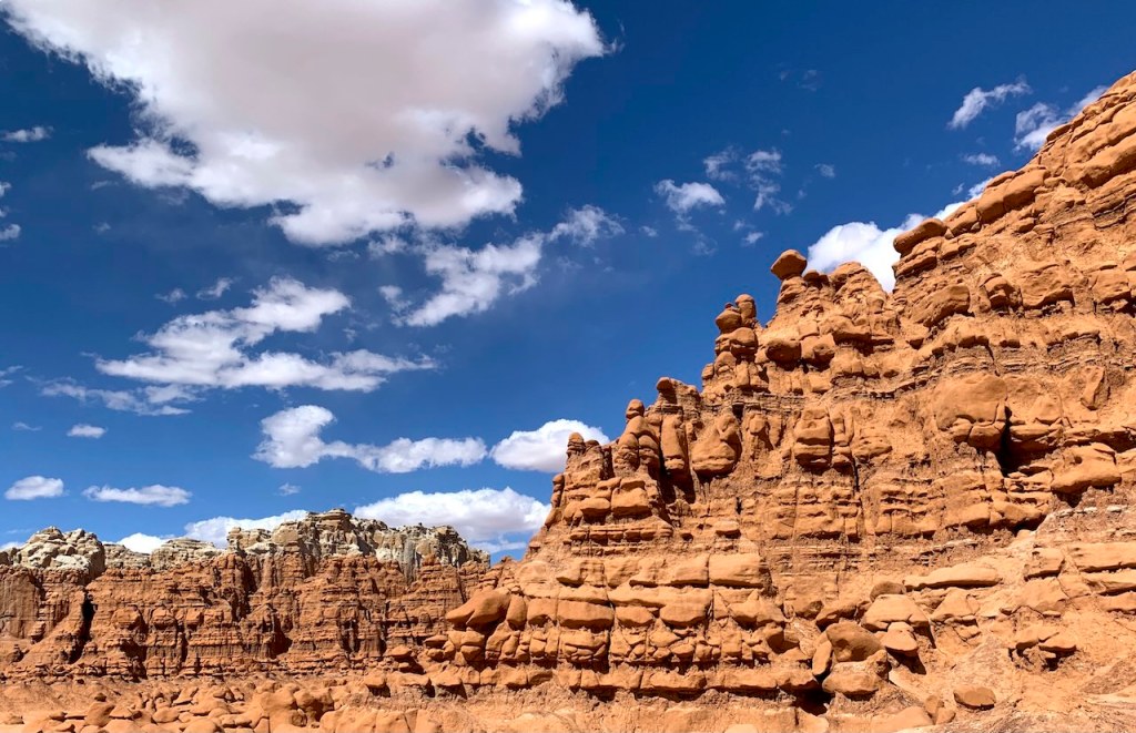
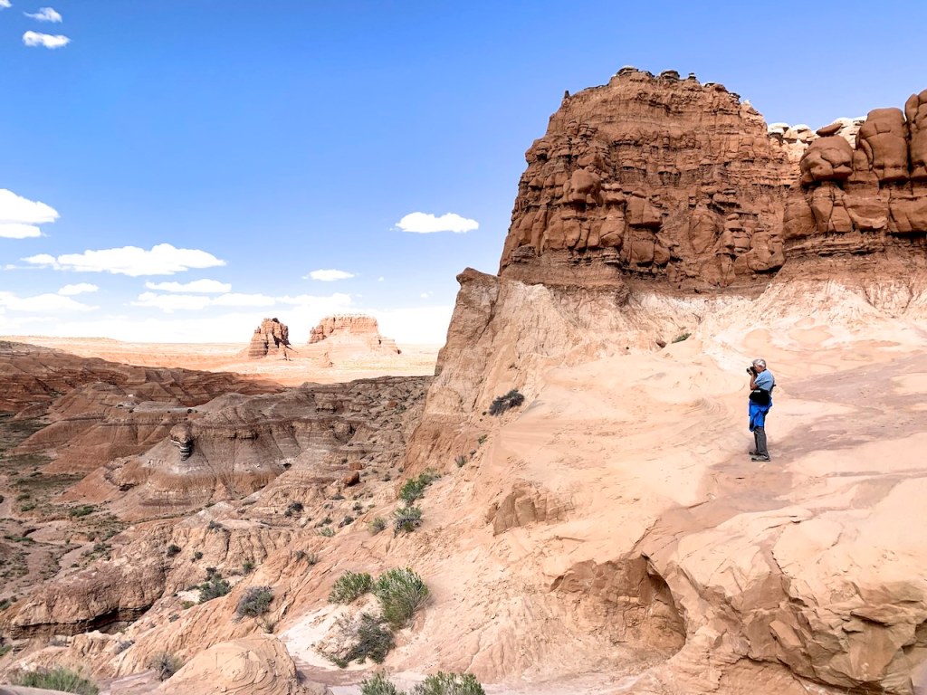
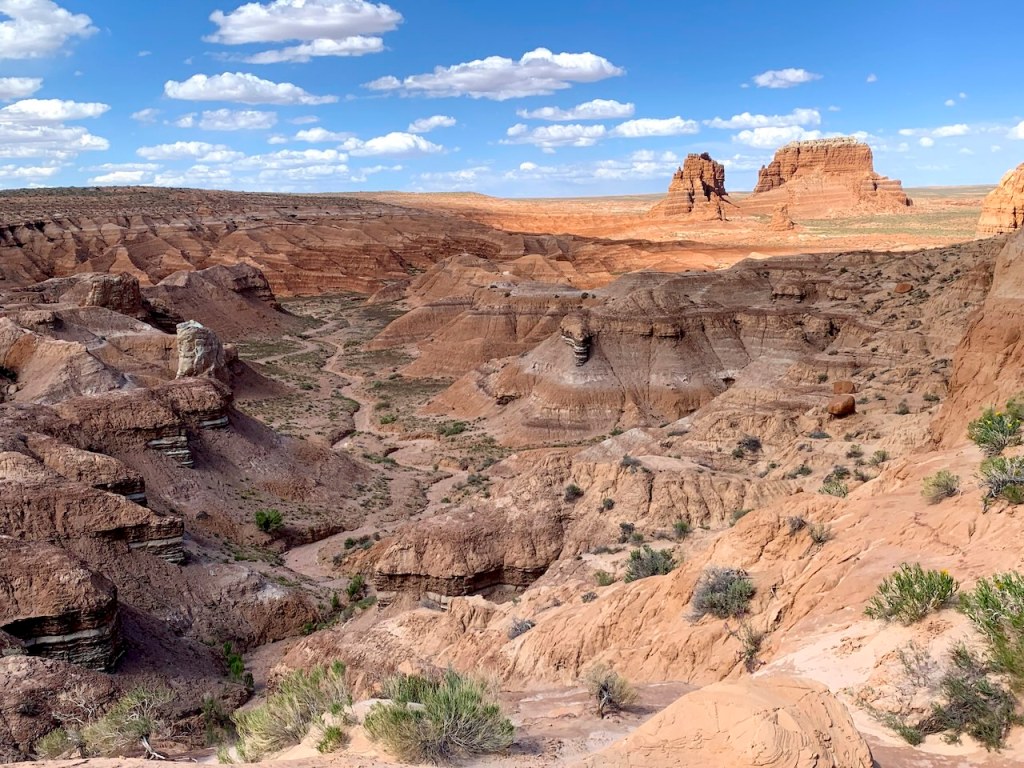
Goblin Valley State Park – The Name Says it All
West of Moab, on UT 24, is Goblin Valley State Park, a maze of strangely shaped red-brown formations (hoodoos) through which children ZOOOOOM. The surreal formations resemble mushrooms and goblins – surrounded by caves, arches, gnomes, cartoon characters and thousands of faces in the cliffs. Spooky under moonlight.
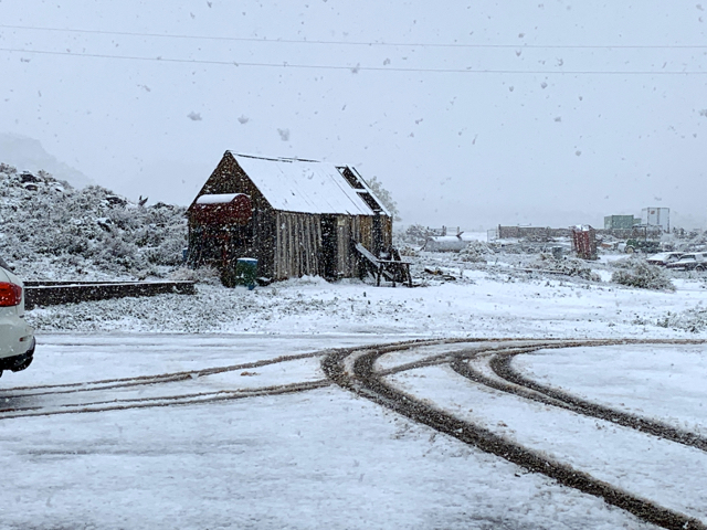
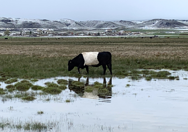
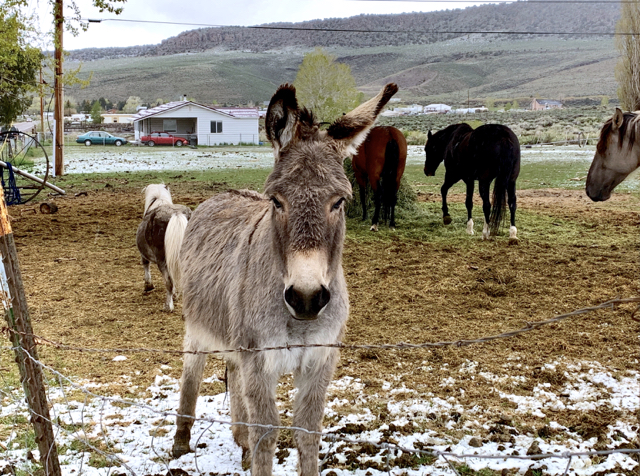
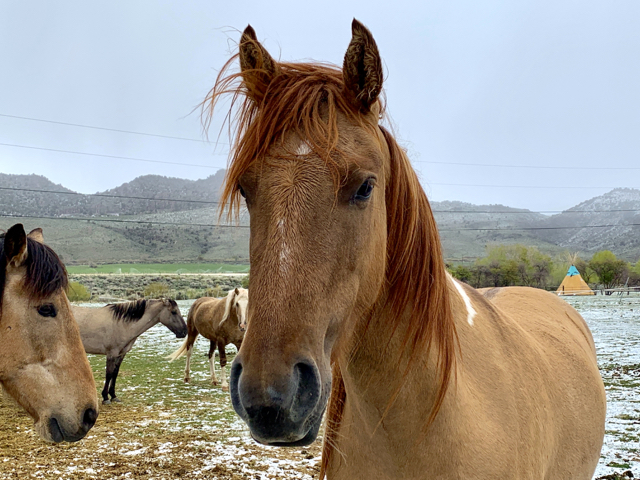
It’s May 27th..snow?
Snow at Capitol Reef prompted us to drive south over the mountain to Boulder. Enroute we made a few acquaintances. The “oreo” cow is a Belted Galloway, and the horse seemed offended by my love for donkeys.

Snow in Teasdale 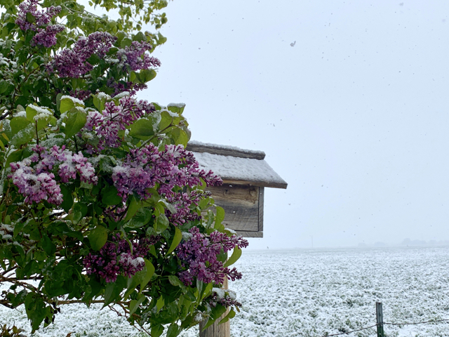
Burr Trail Scenic Backway
Seeing the sun in Boulder we made a “let’s go” decision and drove onto Burr Trail – the only road that crosses the top of the Waterpocket Fold – which means canyons and more canyons. But first, a little climbing on the white steps of Grand Staircase – Escalante.
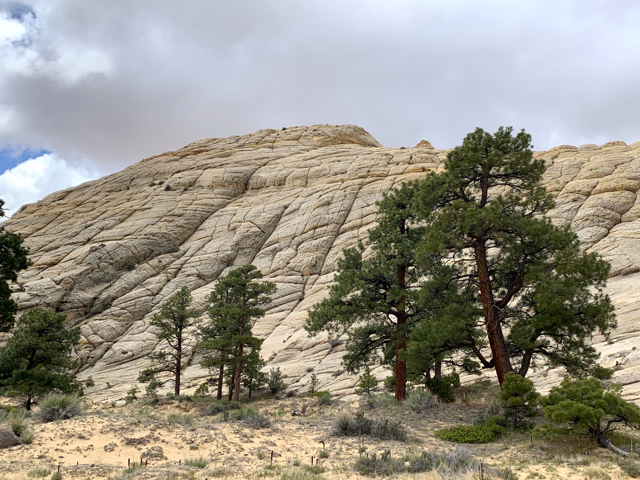
The first 17 (paved) miles on this backroad wound around/up/down and through the deep Long Canyon, topping out with views of Grand Staircase and the Waterpocket Fold. Then the road became dirt and impassable and we turned back.
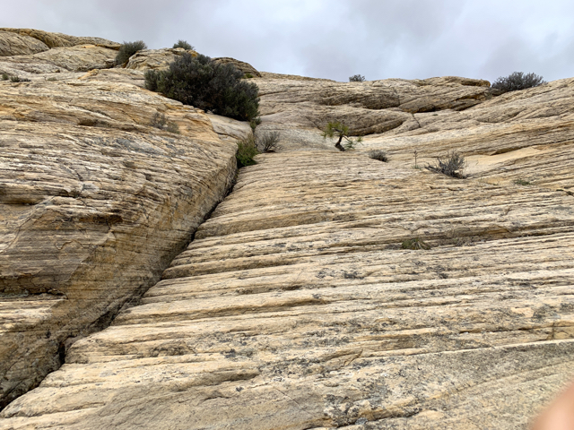
All colors of cliffs in Long Canyon 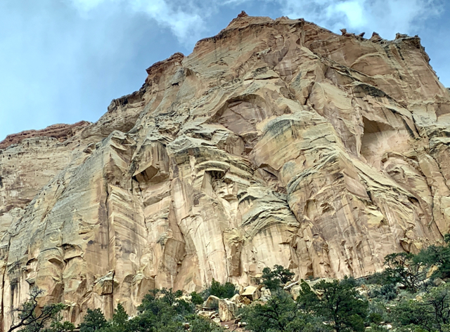
Navajo Sand colored cliffs 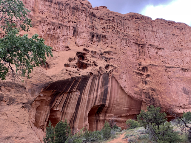
The black streaks are called “varnish“ 
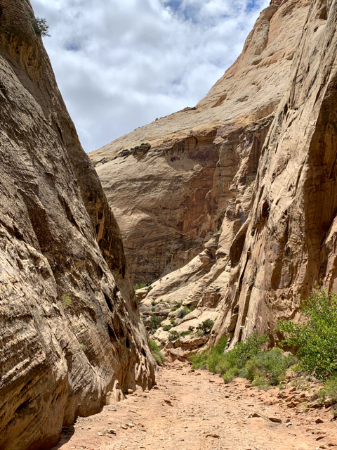
Walking into a short slot canyon 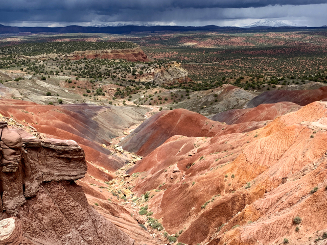
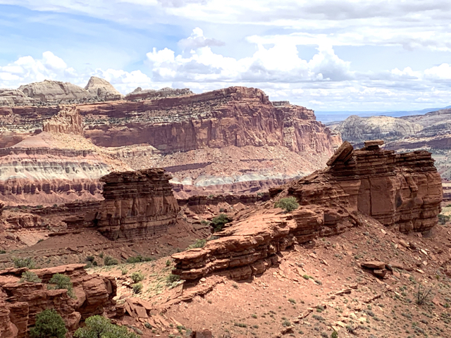
Looking out into Capitol Reef and Grand Staircase
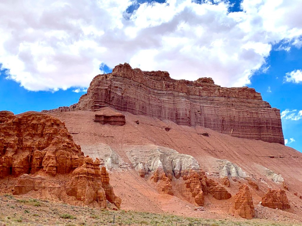
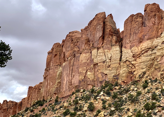
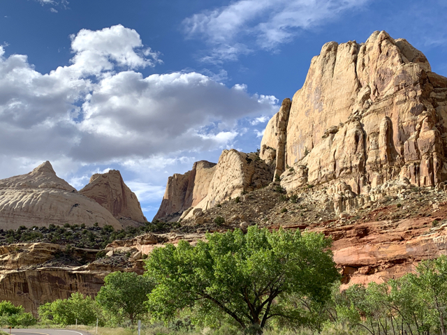
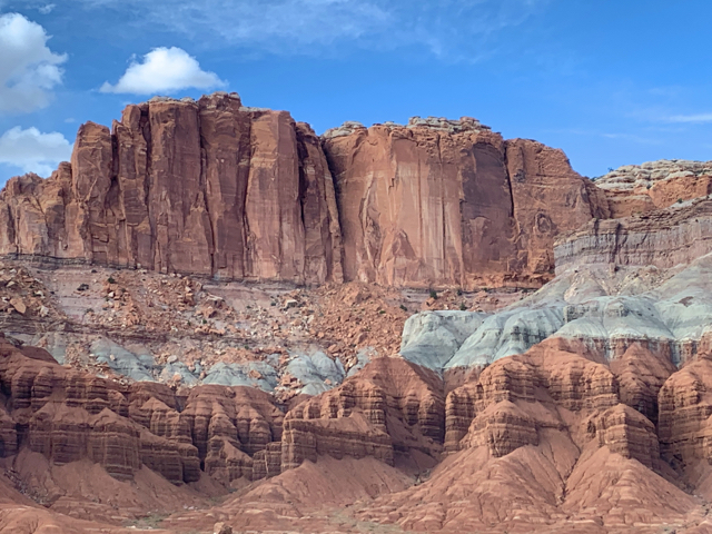
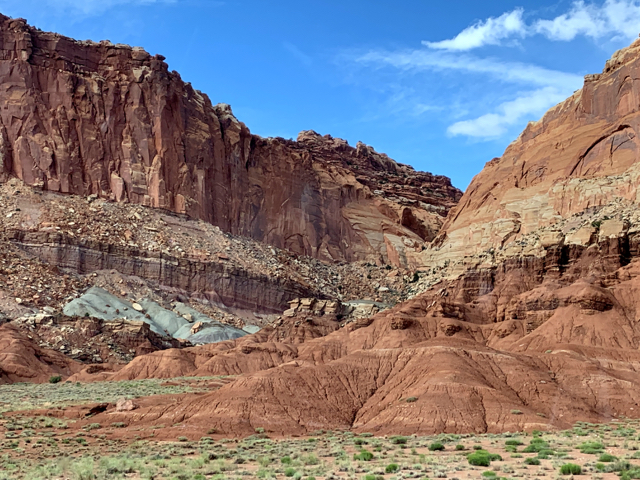
Capitol Reef
Expansive, colorful and a lot less crowded than Arches, but oh, so different. The landmark formation is Capitol Dome, astoundingly white after the dark formations in Arches National Park. Much of Capitol Reef is remote, but the parks’s 21-mile scenic drive is spectacular.
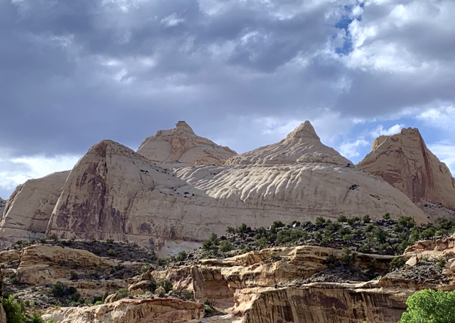
Capitol Dome
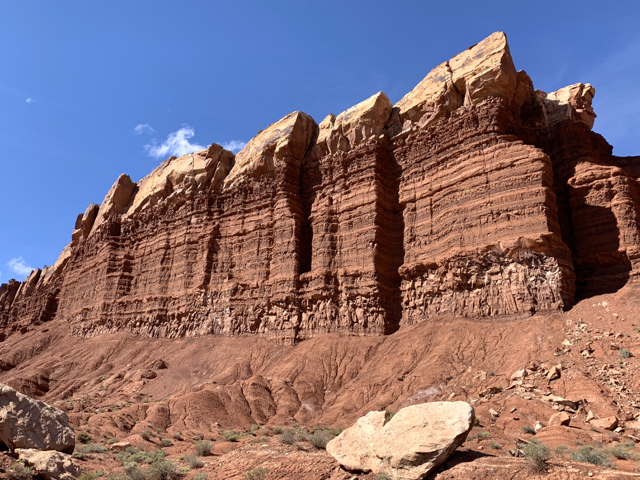
Panorama Point and Goosenecks Overlook – Dizzying Cliffs of the Waterpocket Fold, a “buckle” in the earth’s surface, form Capitol Reef. The cliffs in the park are 2,000 feet high and the fold runs north/south for 100 miles. The rock layers on the west side of the fold have been lifted more than 7,000 feet higher than the layers on the east.
Early explorers found the fold a barrier. They compared it to a reef blocking passage on the ocean… thus the name.
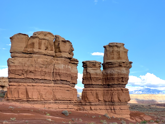
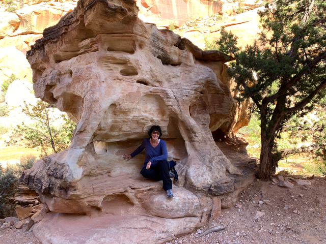
Egyptian Temple Formation
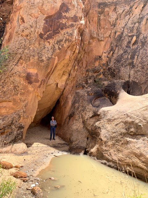
Capitol Gorge – a towering chasm lined with petroglyphs and pioneer graffiti that cuts through the reef. For 80 years, this was the main state highway route. Mormon pioneers cleared a wagon path only to repeat the task every time boulders were rolled in by flashfloods. Cars bounced through the canyon until 1962, when highway 24 opened east of the park. Now it is a hike on the gravel riverbed.
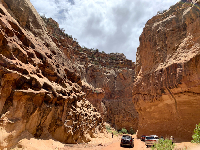
A cool drive to the canyon….then you walk 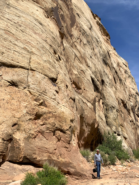
Rock art in the gorge includes a “pioneer register”, petroglyphs by the Fremont people and a trail to natural water pockets (tanks) imperative to survival.
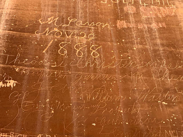
Pioneers signed names and dates (from 1800s to 1940) 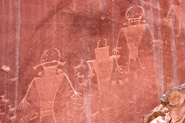
Petroglyphs visible throughout the park 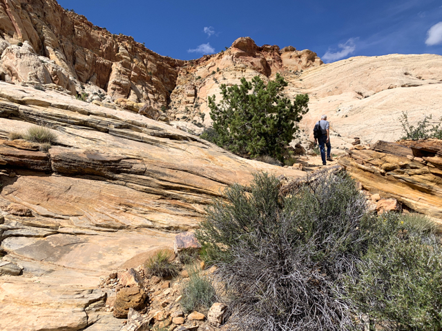
Up to the Tanks on slickrock 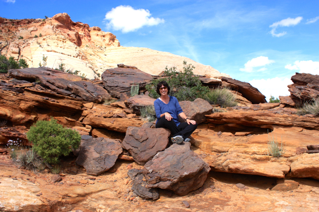
Very narrow passage over a Tank 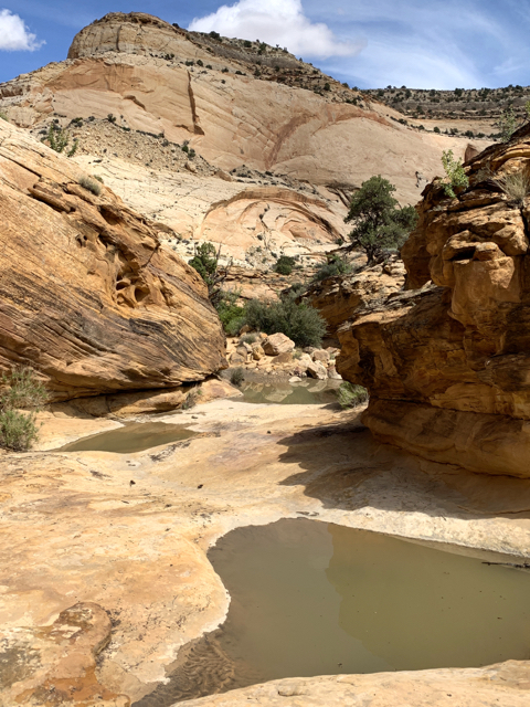
The Tanks 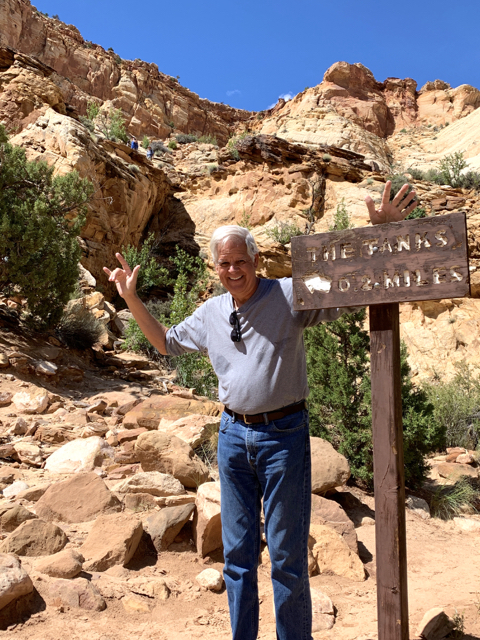
Steve – Done! 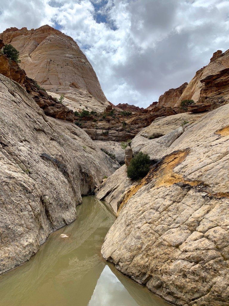
The Tanks
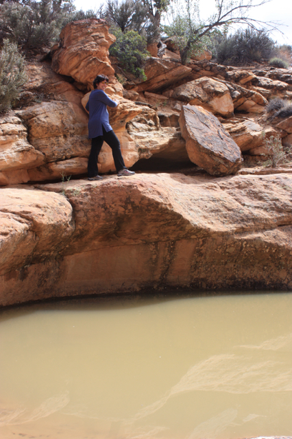
Grand Wash is a canyon that cuts through the reef. The wash is a channel path that follows the riverbed, typically dry except when we were there. I hiked until I saw mud at the start of the narrows. They say Butch Cassidy (and The Hole in the Wall Gang) hid out here in the 1890s.
The Hole in the Wall 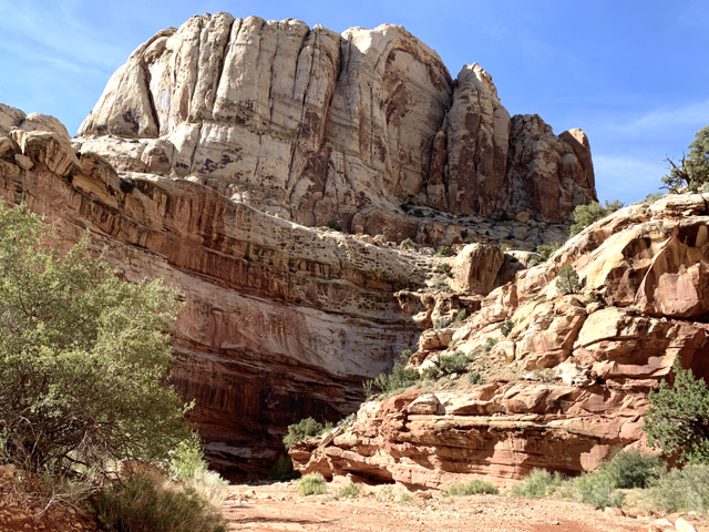
Before the Narrows 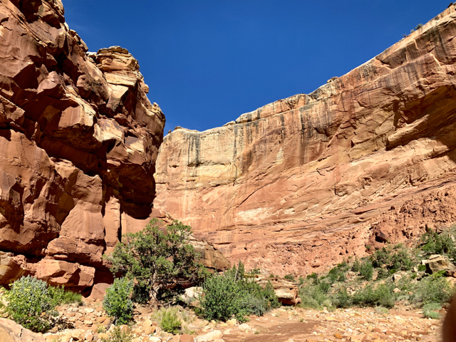
Always one more corner 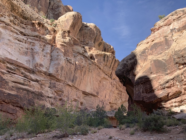
And another…hard to stop
Radioactive! “Elevated radiation levels due to uranium mines. A maximum of one day should be spent in the area. The area water is highly contaminated.” So of course I checked it out while Steve stayed a safe distance away. The shaft is a protected bat habitat (protected from people).
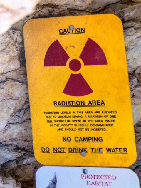
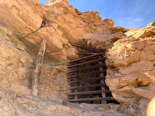
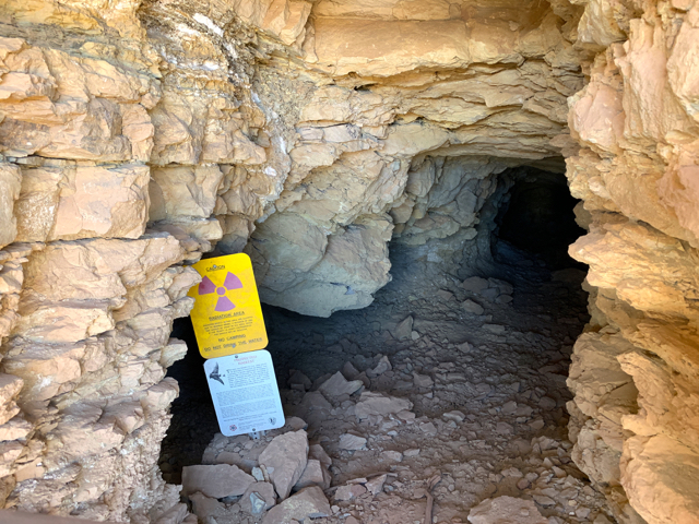
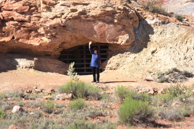

Mine shafts at the bottom of this range
Recommendations
- West of Goblin State Park, a dirt road continues to an edge of the San Rafael Swell. This is a glimpse into 663,000 acres of red rock glory and home to Utah’s largest herd of bighorn sheep.
- Little Wild Horse Canyon, on Goblin Valley Road, is a slot canyon that “anyone can do”. It gradually narrows to less than a couple of feet at points, (and there may be ankle deep water).
- Grand Wash Trail – 4 miles from beginning to end. “A good substitute for the Zion Park Narrows.” How hard can it be?
- Hikes we missed: Cassidy Arch, Hickman Natural Bridge
- Visit in autumn and you can pick and carry orchard fruit (planted by settlers in the 1880s) in the park.
- Green River – we found the John Wesley Powell River History Museum. In 1869, Powell, a one-armed civil war major led a mapping expedition from Wyoming to the Grand Canyon. A well-curated museum and river walk.
Book: Paddling the John Wesley Powell Route by Mike Bezemek, or follow this link for his story. https://www.oars.com/blog/john-wesley-powell-grand-canyon-first-descent/
Subscribe to receive emails for new posts
Click bullets to view our other destinations
Discover more from Travel Broadly - Marlene & Steve
Subscribe to get the latest posts sent to your email.

Ohhh wow, feels a bit like traveling … still…. next next next on our list !
LikeLiked by 1 person
Nice pictures!!!
LikeLiked by 1 person