This post is about the wild side of Madeira with its steep terrain, sparsely populated villages, and cliff views. It aims to inspire you to visit and reminds me to return.
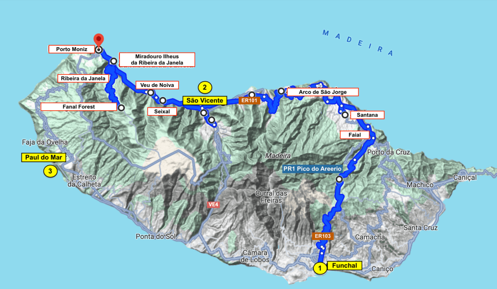
Visiting Madeira, we stayed in three different places over 2 weeks in January 2023: 1) Funchal (click link to read previous post, Madeira – Funchal); 2) São Vicente, located between Santana and Porto Moniz; and 3) Paul do Mar on the south-west coast.
DAY 1: Driving North
Straight Shot vs Scenic Drive
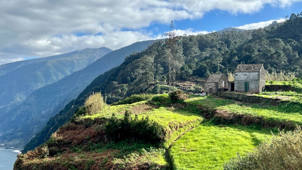
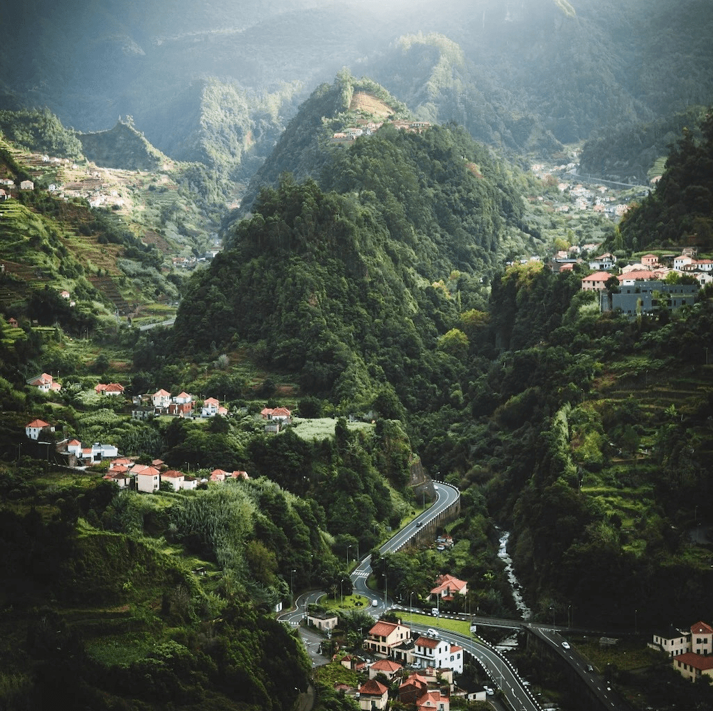
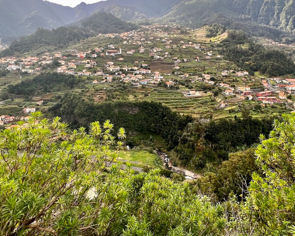
São Vicente, north of Funchal, can be reached in 45 minutes via VE4. Alternatively the ER103/101 route equals hours of meandering around curves, steep slopes and over plunging ravines – the scenic route.
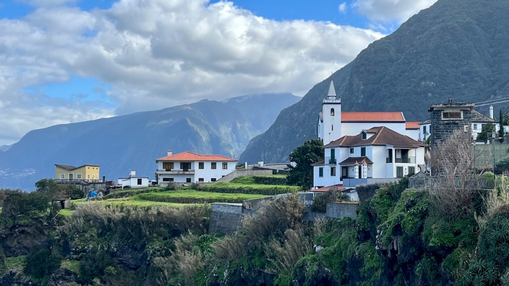
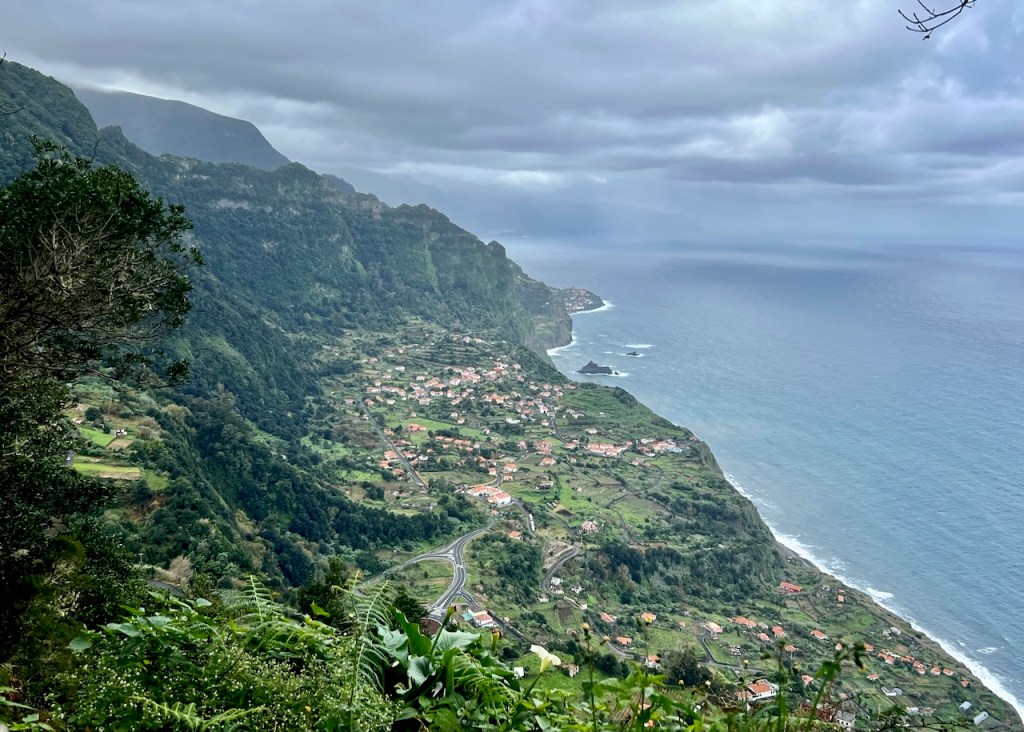
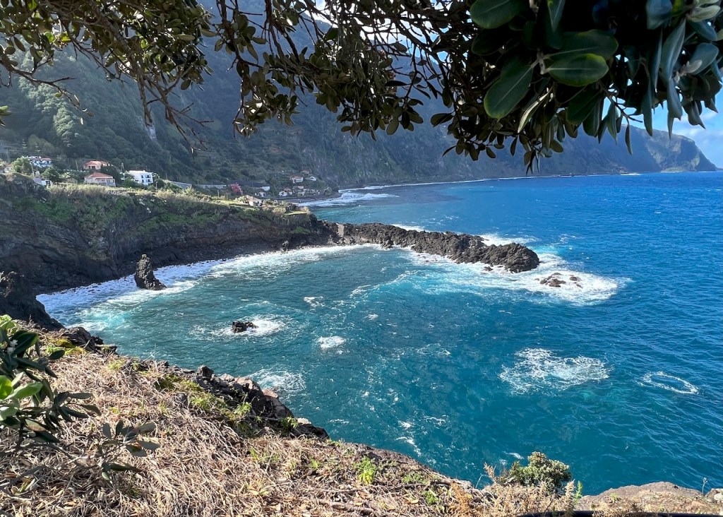
Madeira roads: The VE (Express) or VR (Via Rápida) are direct routes using endless tunnels. ER roads serpentine over mountain and valley, but you see so much more – like this vista over Arco São Jorge, typical of the many seaside villages.

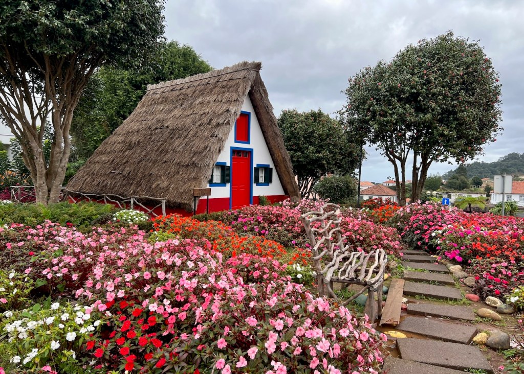
Santana, Picture-Book Village
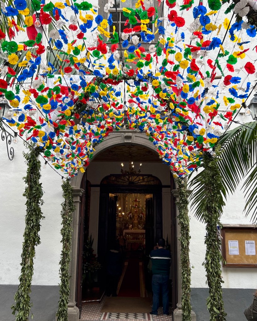
Santana, a mountain village, has a display of unique triangular thatched-roof houses. A brief visit, but seasonal festivals enhance the experience.

Day 2 – 3: Walking São Vicente
Steep hairpin turns through a narrow valley end in São Vicente, established in 1532, current population less than 6,000, with very little flat space!


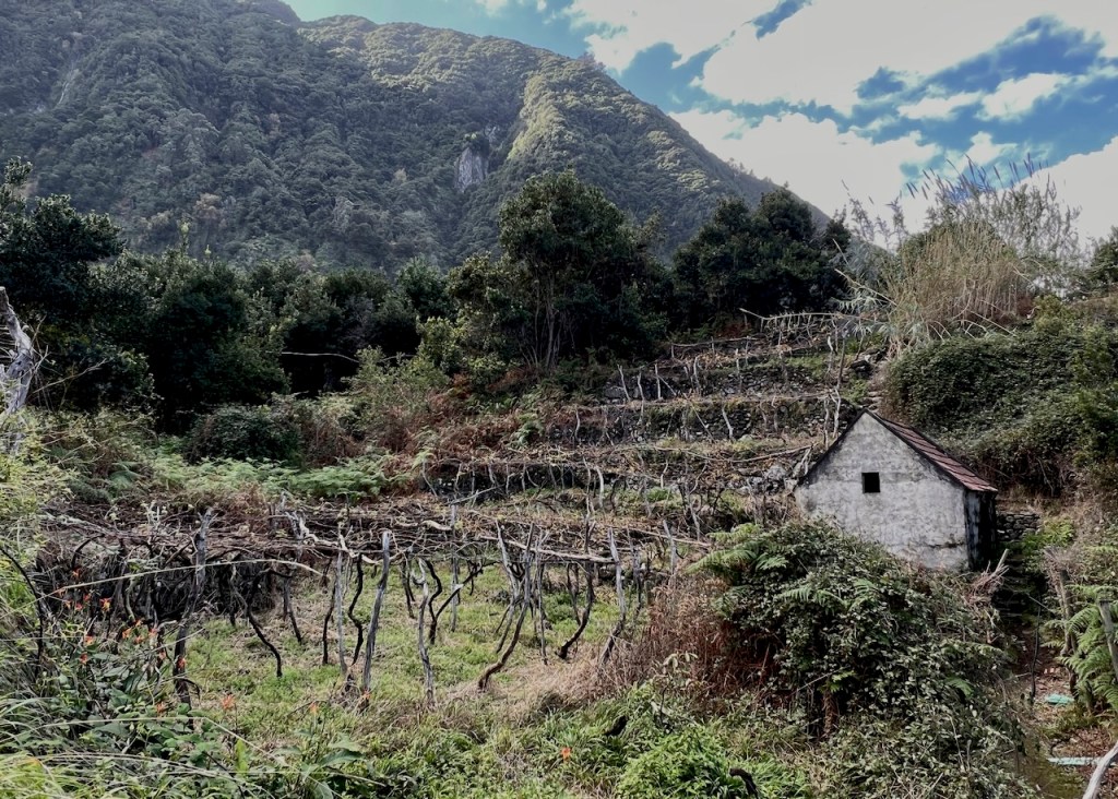
The surrounding mountains are covered with the world’s largest remaining area of ancient laurel forest, dating back to the dinosaurs.
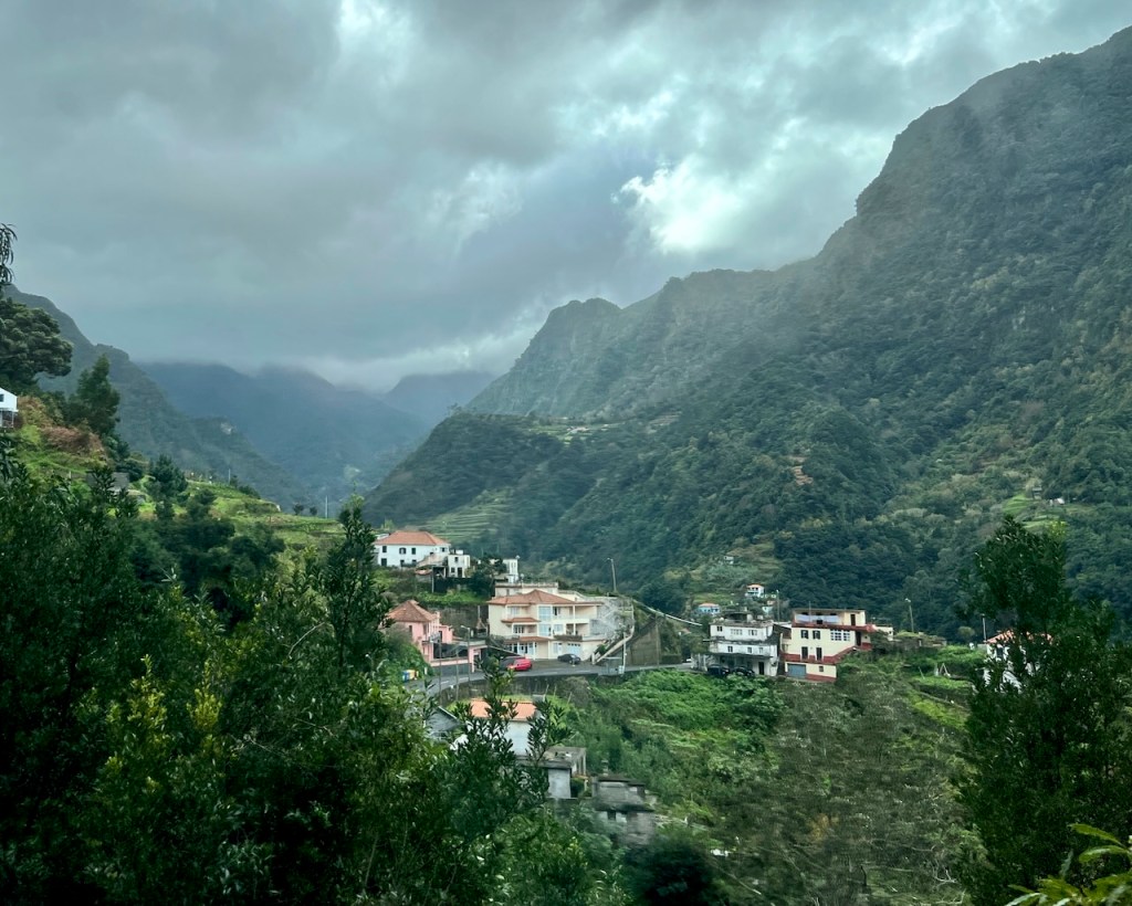
São Vicente sits on the valley floor with a few seaside rustic bars and restaurants, (Madeira wine tasting). The historic town center is a few blocks inland, and that’s it for flat . . . everywhere else around town is quite the uphill hike.
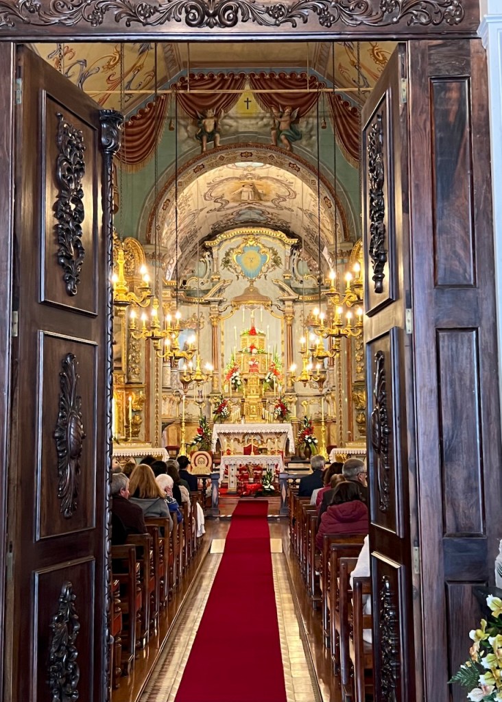
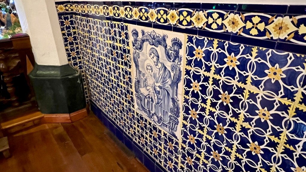
The 17th century São Vicente Parish Church has a stunning baroque ceiling, blue azulejos (tiles), and an 18th century pipe organ.
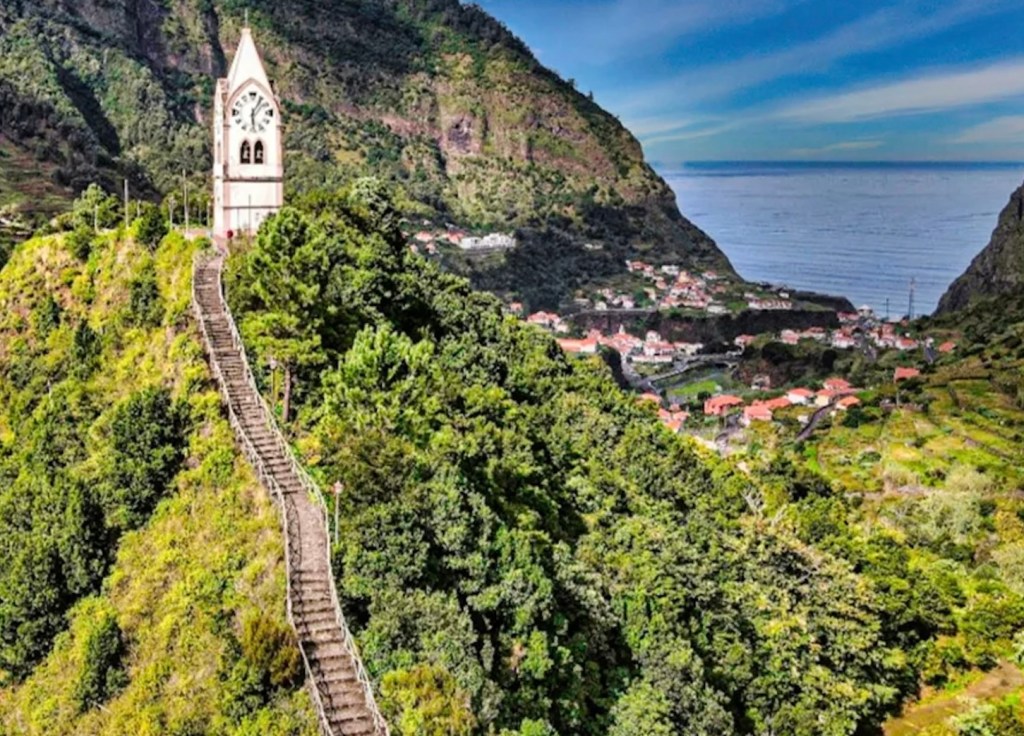
The landmark chapel/clock-tower, Capelinha Torre de Nossa Senhora de Fátima, sitting 2 km uphill is visible from everywhere in the valley. Views are incredible (take a cab up, walk down.)

Day 4 – 5: Sightseeing between São Vicente and Porto Moniz
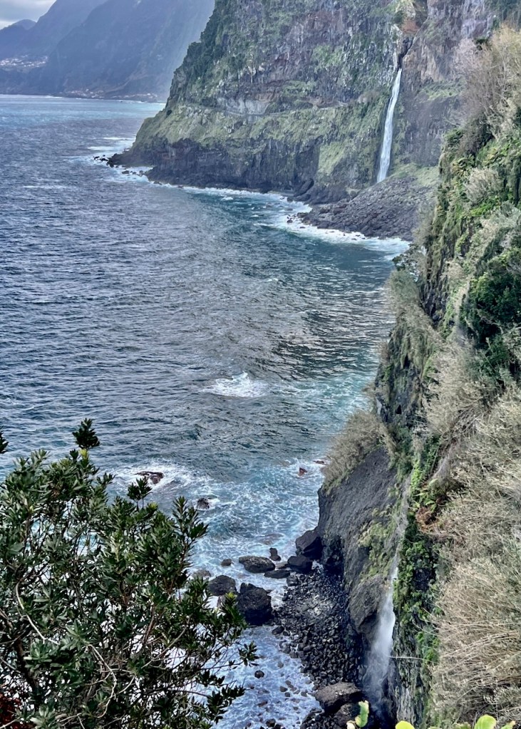
Véu da Noiva Viewpoint (Miradouro)
Véu da Noiva, translates as Bridal Veil Waterfall. The incredible scenic lookout on Antigo (old) ER101 has views of a long waterfall pouring from the cliff.
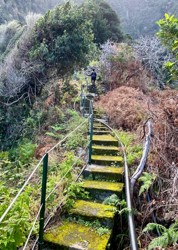
Nearby is a hidden hiking path. Walk a short distance from the carpark/tourist shop to a small pull-off. The trail begins behind the guardrail.
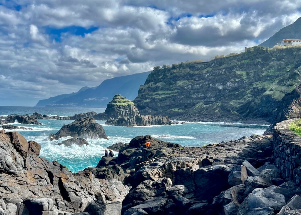
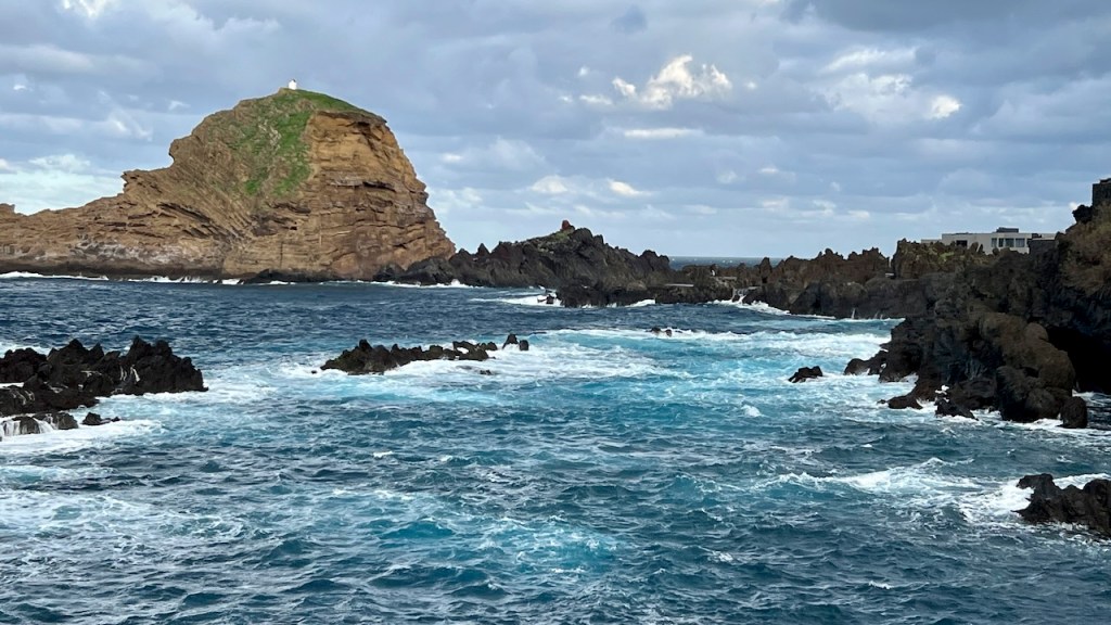
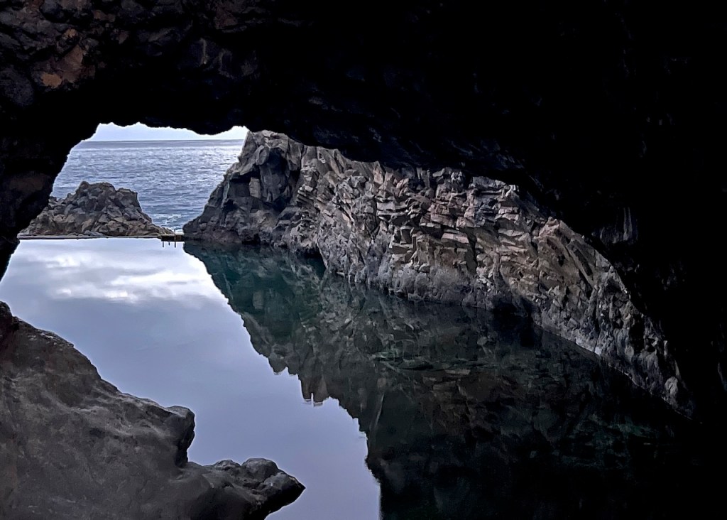
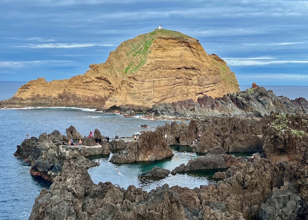
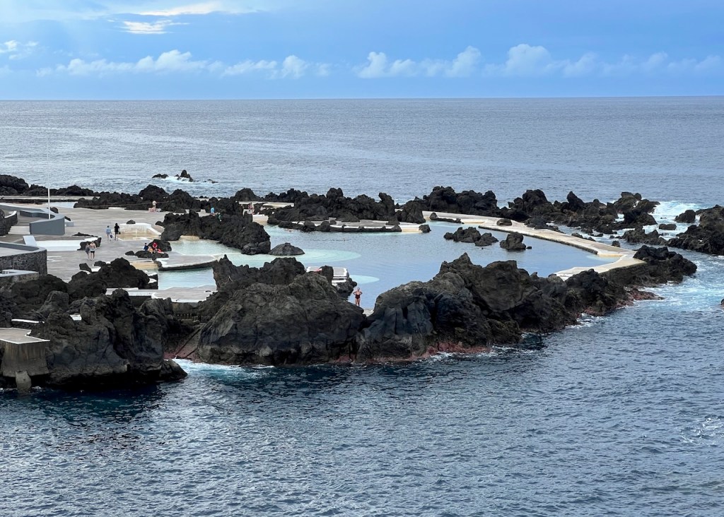
Seixal and Porto Moniz, Piscinas Naturais
Formed by volcanic rocks, the natural pools are a main attraction of the north coast. Clear seawater enters naturally and the lava protects you from being carried away by the waves.
Seixal Natural Pools
Known as “Poça das Lesmas” (Puddle of Slugs), these tidal baths have a beautiful rock arch. The road/walk DOWN to the pools long and steep.


Night view
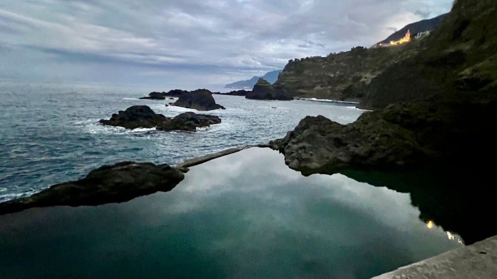
Porto Moniz Piscinas Naturais
In Porto Moniz you can swim within the natural formations, or a walk down the promenade for the life-guarded lava pools.
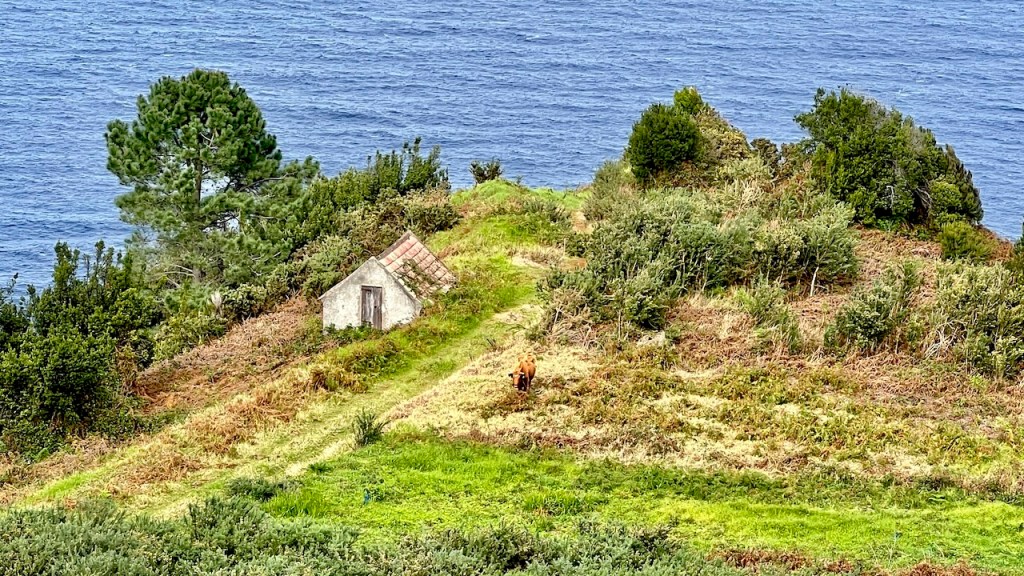
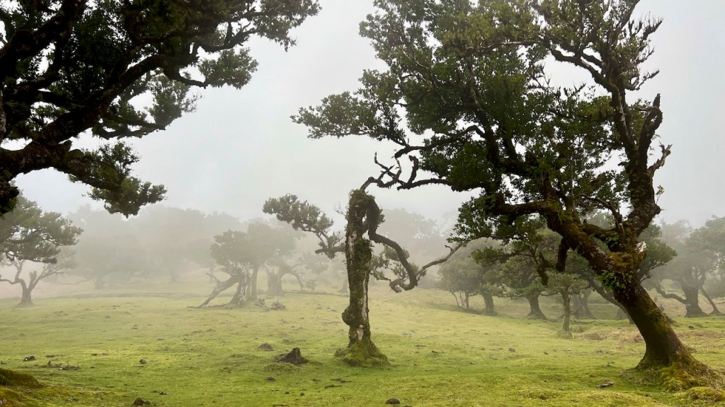
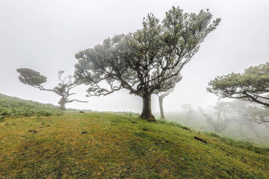
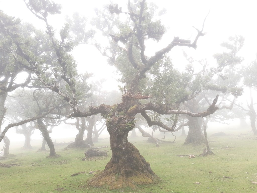
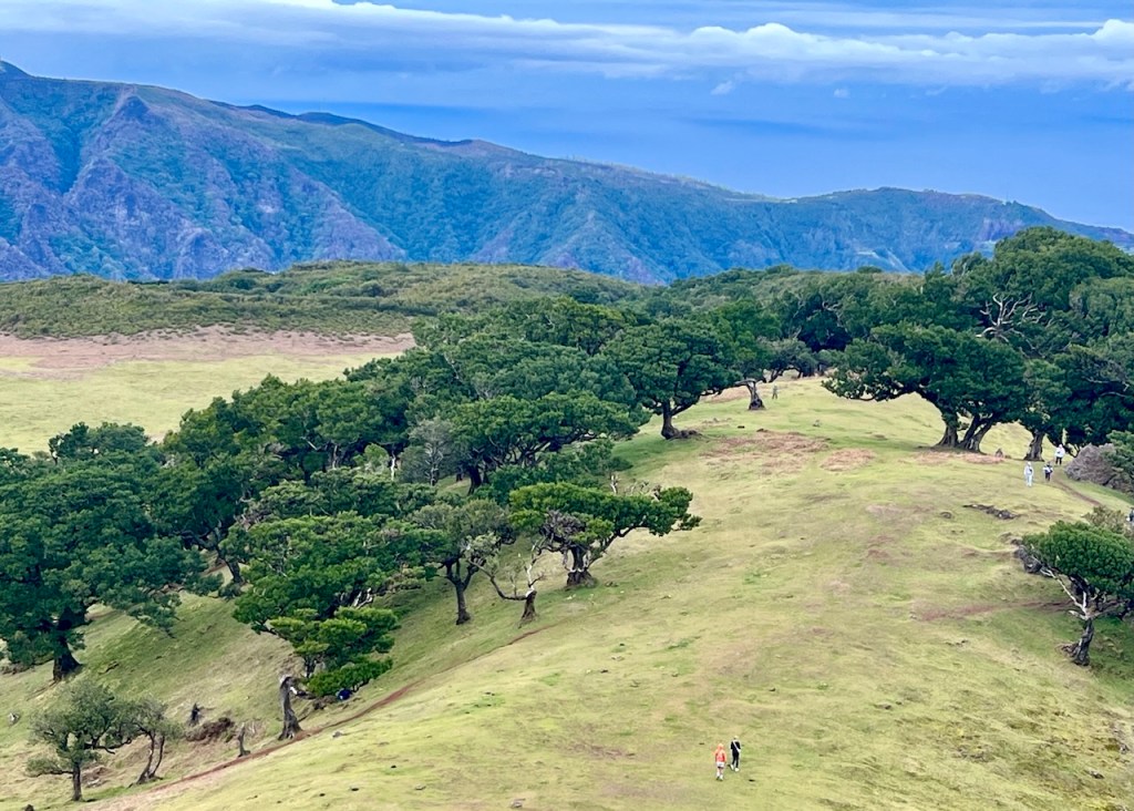
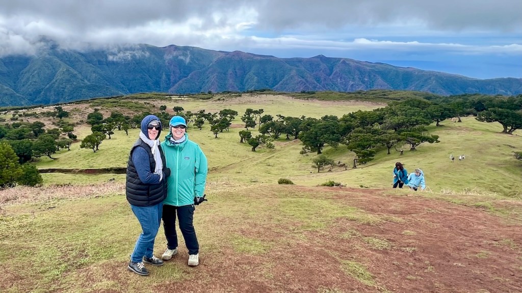
Fanal Forest, UNESCO World Heritage Site. Best When Foggy!
History: Laurisilva forests once covered 90% of Southern Europe and NW Africa. Today 10% remain found only within Madeira, the Azores and the Canary islands.
Lovely on a clear day, but when fog descends, these twisted 600 year-old trees are surreal. You walk in a cloud and it can be cold! Your best chance of fog is the morning, or if rainy or cloudy on the south coast, it will likely be foggy up here.
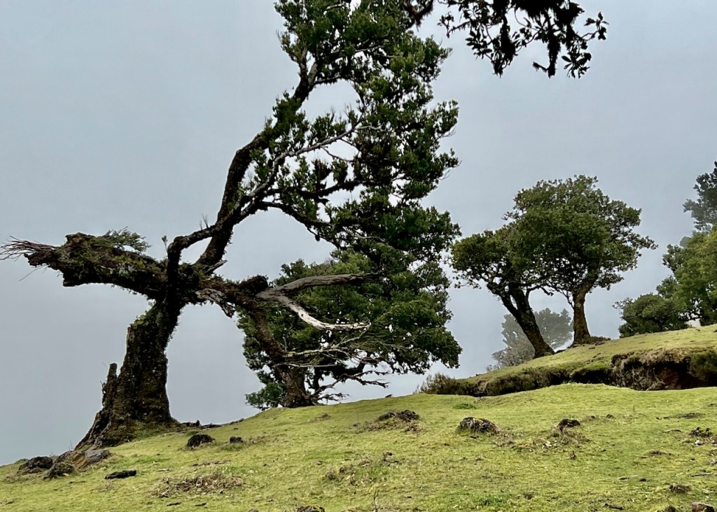
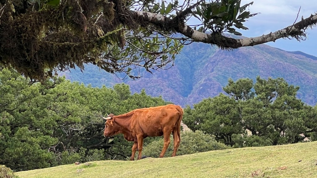
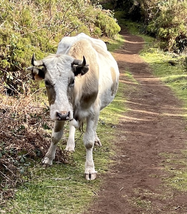
The cattle roam freely.
Directions: Google Maps – “Faial Parking”. Hikes: PR 13 (Trail 11 km, 4hrs.), PR 14 (Levada 7.2 km -3 hrs).
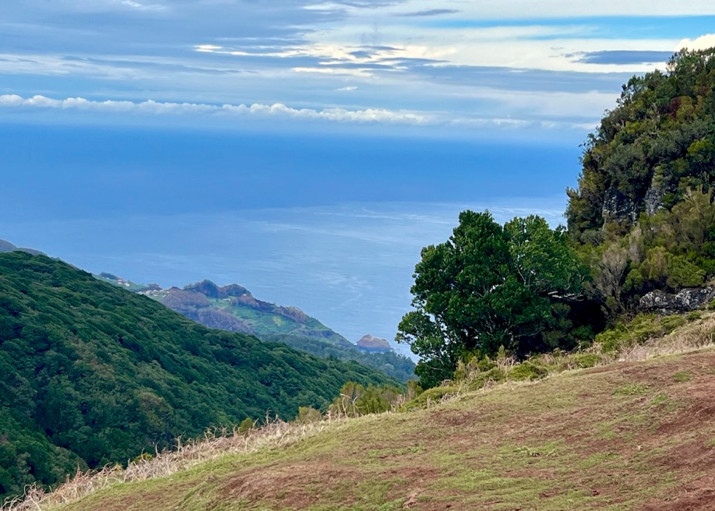
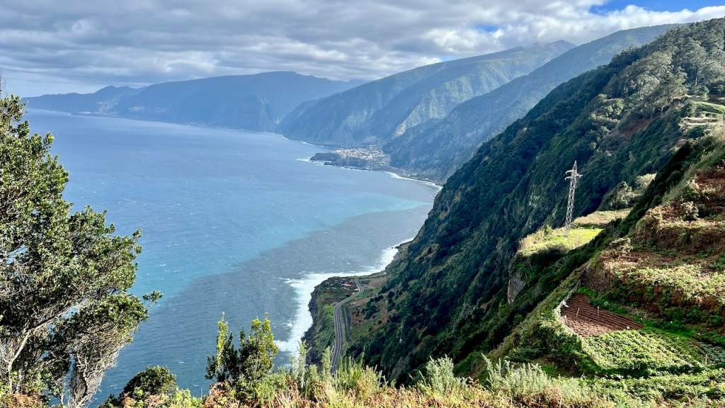
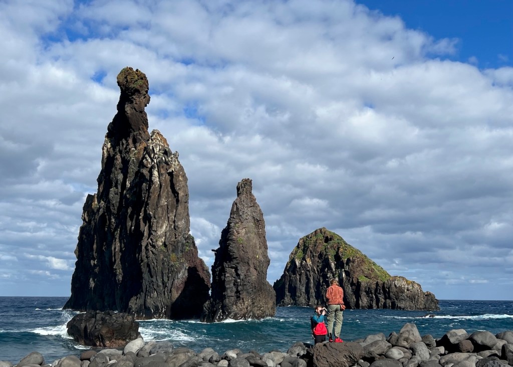
Riberia da Janela
The miradouro at the Ribeira da Janela Swing provides intense views of the Atlantic Ocean and the island’s cliffs. On the beach below are Iheus da Ribeira da Janela‘s rock formations: Ilhéu Alto (tall rock), Ilhéuzinho (little islet), Ilhéu da Rama (Islet of Rama) and Baixinha (short).

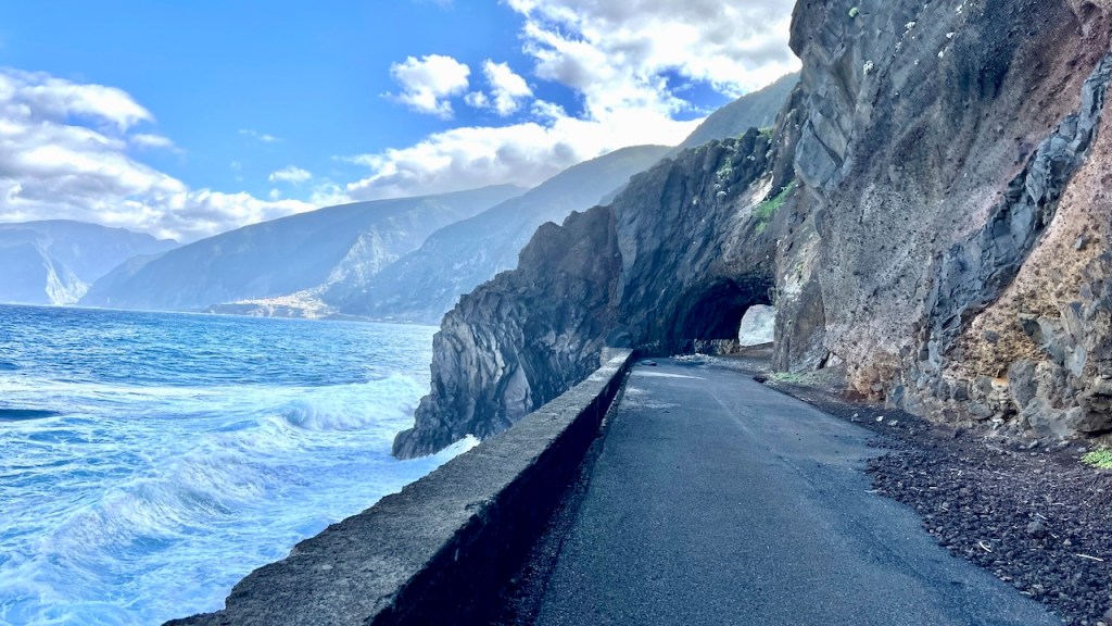
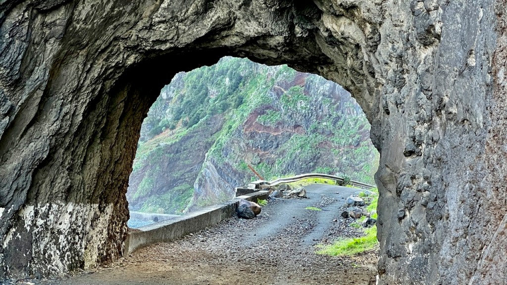
Walk the abandoned sections of ER101 Antigo, connecting São Vicente and Riberia da Janela.

Hiking Guidance
If hiking is your game, the IFCN website provides daily trail status, no matter the season. Checking this link is important: IFCN – Pedestrian Paths (fires, landslides, severe weather). Alternative Link: Pedestrian Paths – At A Glance
Next Time Up North
- Close to São Vicente, Nuns Valley – Curral da Freiras, (see link) a picturesque village at the bottom of a volcanic crater. In 1566, nuns hid there when French pirates attacked Funchal.
- “Peak to Peak Hike” – PR1 – PR1.2 at Pico do Arerrio (All Trails link)
- Walk the Old Road ER101 Antigua from Sao Vicente to Seixal (link)
Next Post: Madeira South – Paul do Mar
Previous post, Madeira – Funchal
To receive an email message for a new story, sign up here. (No advertising!)
Click shortcuts below for
- Home/Destination Menu Bar
- Photo Gallery/Compilations
- USA Posts
- Mexico
- New Zealand
- Switzerland
- Nature Posts
- Portugal
- Spain
Discover more from Travel Broadly - Marlene & Steve
Subscribe to get the latest posts sent to your email.

Another gorgeous virtual tour… thank you!
LikeLiked by 1 person
Thank you! These places practically photograph themselves!
LikeLike
What a beautiful post Marlene! I’m totally enchanted and felt like I was there. So thankful for this chance to absorb the beauty.
LikeLiked by 1 person
Wow. Enchanted is a perfect word! Thank you!
LikeLiked by 1 person
Sort of like Magic Mountains, which I hope I have enough stamina to climb a couple when we return
LikeLike
Wow. Enchanted is a perfect word! Thank you!
LikeLike