Where Sprits Soar!
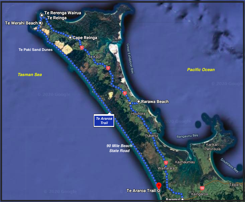
I am often without words to describe Northland, NZ, so let’s take it from the top. The Aupouri Peninsula caps Far Far North with glorious east/west beaches, Bay after bay is a picture-book spot for a swim, walk or picnic. Cape Reinga, at the tip, is breathtaking and the point where the spirits of the dead enter the underworld

Trip details – We spent two nights in Kaitaia (Air BnB), and we still felt rushed.
Along the way – Outstanding Wineries/Cellar Doors Karikari Estate, Dancing Petral.
Squeaking Silica
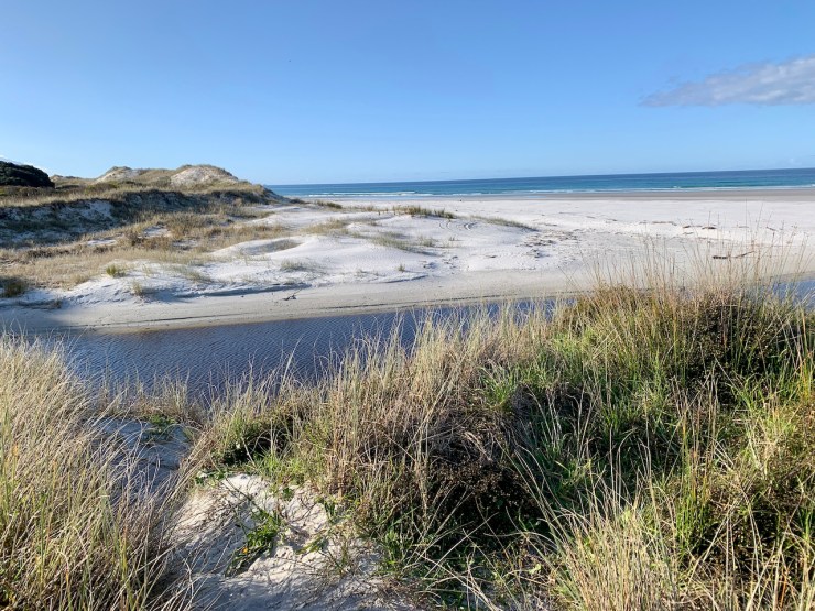
Halfway, on the east side, you’ll need sunglasses to offset the brilliance of Rarawa Beach with its near-pure white silica beach that squeaks with each step. Push on…because you want to get to THE TOP.
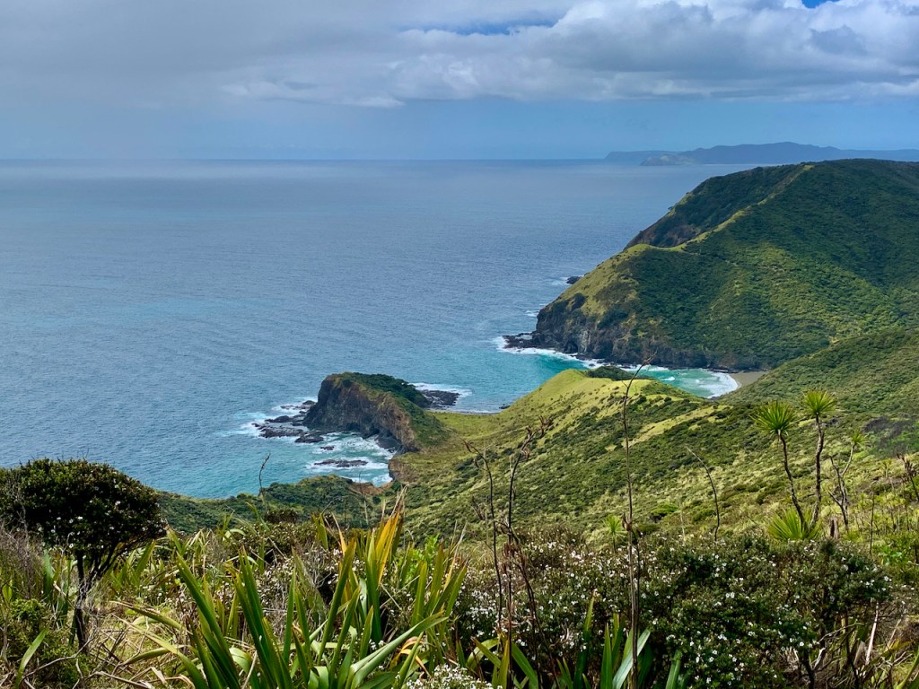
First Glimpse at the Top
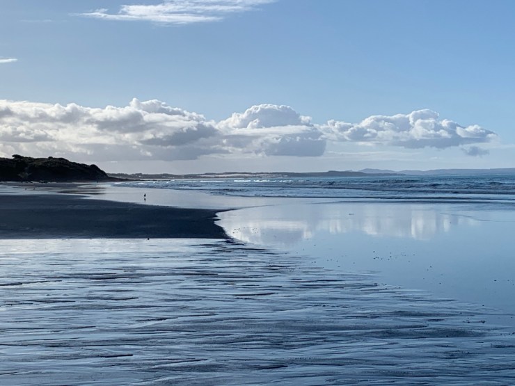
Near the road’s end, a view to sand dunes, the spit, and the sea. The lighthouse awaits.

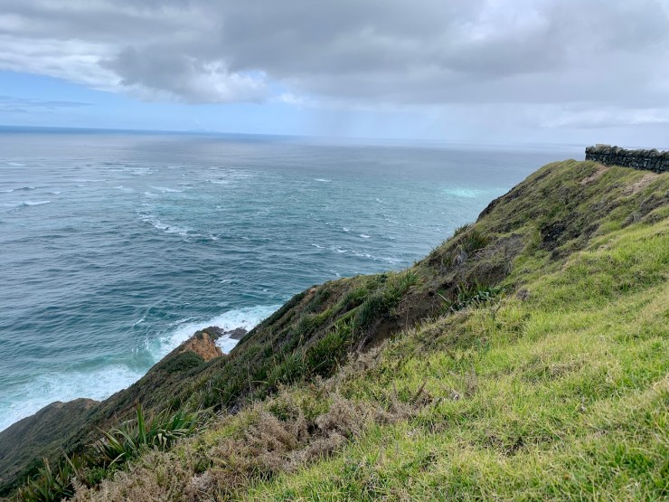
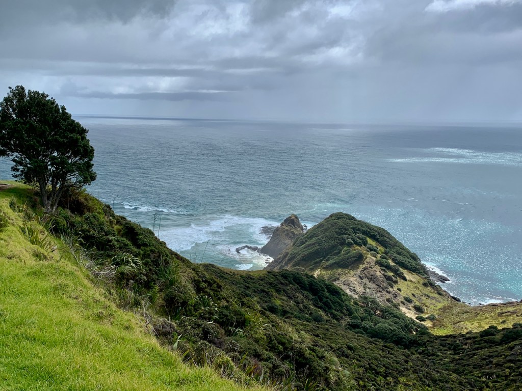
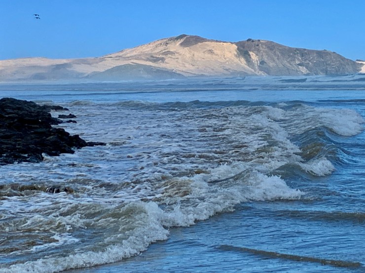
Where the Seas Collide
Far below, at tip of the peninsula, the Tasman Sea and Pacific Ocean swirl and slam together.

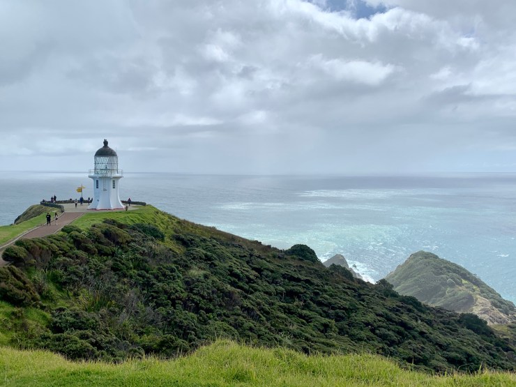
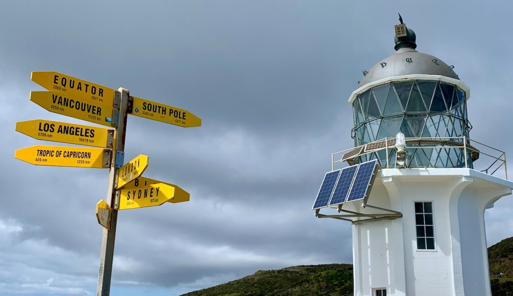
Drawn to the Lighthouse, a NZ Icon
First used in 1941, Cape Reinga Lighthouse (Te Rerenga Wairua) towers above the swirling seas.
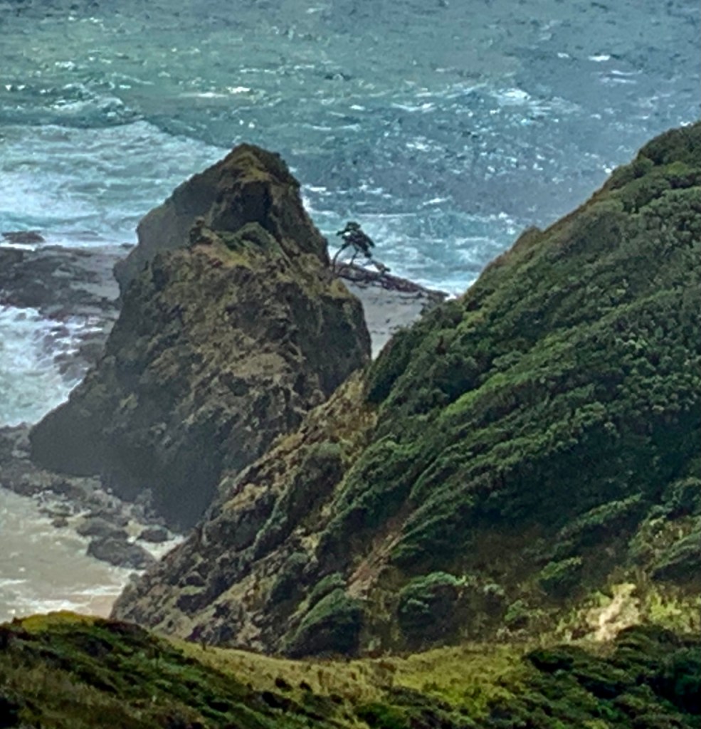
Cape Reinga’s Spirit Tree
The Māori word Reinga, means ‘underworld’, and ‘Te Rerenga Wairua’, means ‘the leaping-off place of spirits’. Both refer to the Māori belief that the cape is the point where the spirits of the dead enter the underworld. For Māori, Cape Reinga is the most spiritually significant place in New Zealand.
Below the lighthouse on a rocky point survives a lone weather-beaten 800 year-old pōhutukawa tree (barely visible in the first photo). The tree is the jumping point for the spirits departing Aotearoa (NZ), descending to the watery underworld (reinga), and ultimately their spiritual ancestral home.

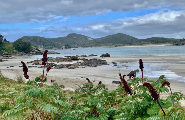
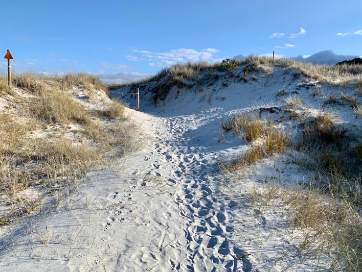
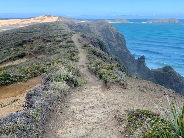
Te Werahi Trail
Below the lighthouse is Te Werahi Trail, a 2 km track down past steep cliffs to sweeping Te Werahi Beach, with tremendous views worth the short hike.
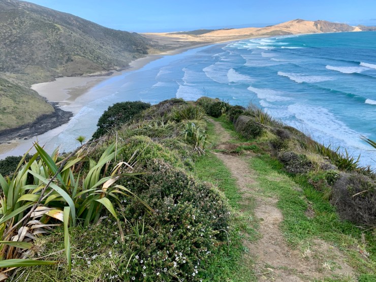
Te Werahi is the terminus of the famous Te Araroa Track “The Long Path”. Te Araroa is a 3000 km (1864 mi) track from Bluff, South Island to Cape Reinga, North Island. It takes 4 to 6 months to tramp end-to-end. Some stretches are rough and undeveloped; I reckon it’s a challenge.
A fun book about Te Araroa is The Pants of Perspective (link) by Annie McNuff who RAN it. I traced her steps on the stunning Te Werahi trail leg below the lighthouse. WOO HOO! (ok…it was less than 4 km, I would have continued…but high tide rushed in.)


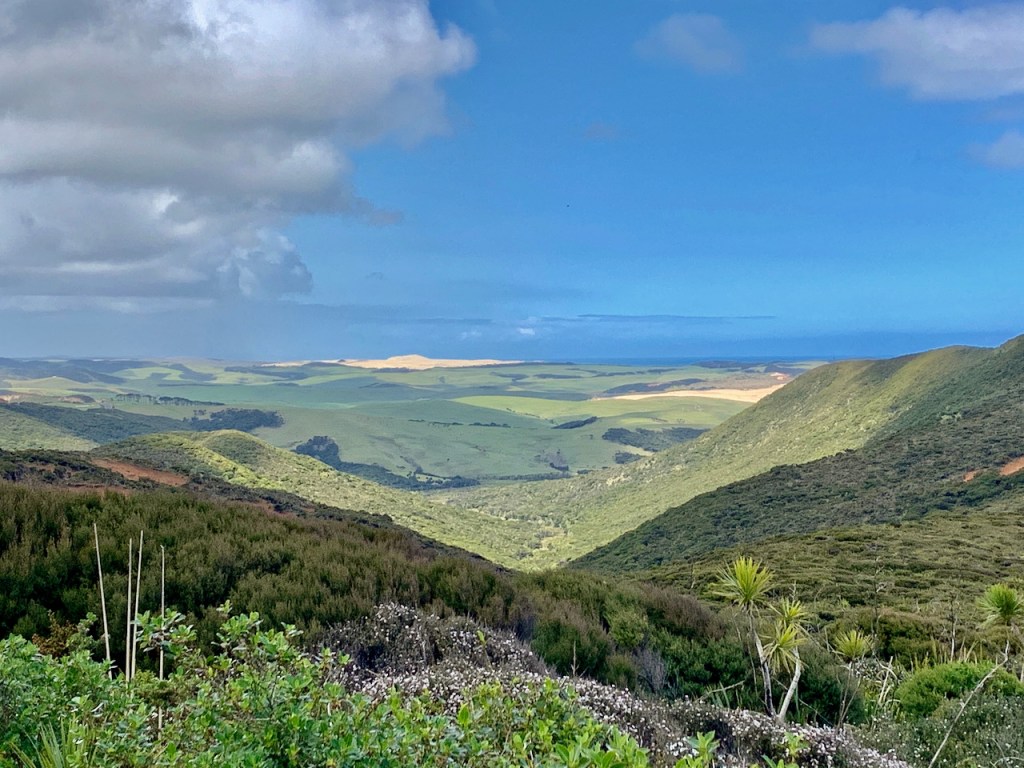
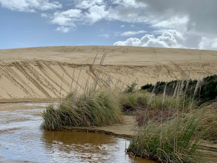
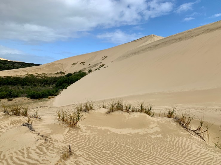
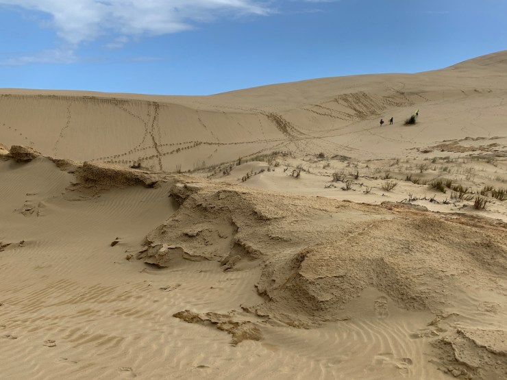
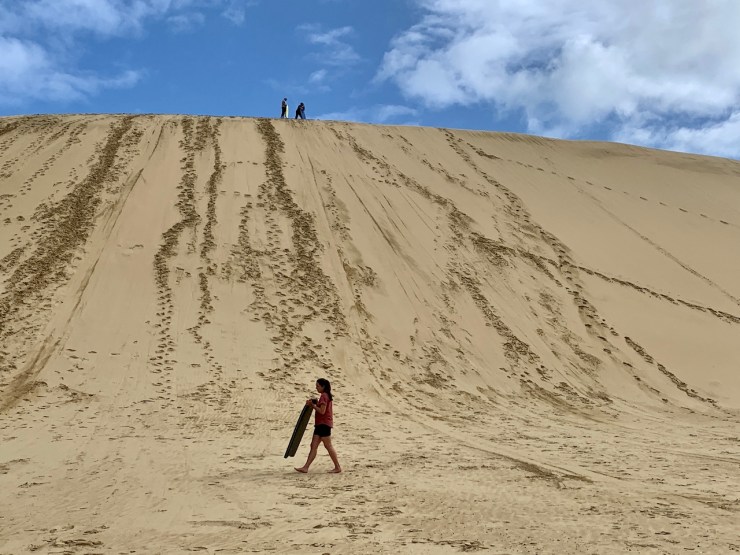
Te-Paki (The Sun) Giant Sand Dunes
Desolate, gorgeous 400ft high dunes span 6 miles of coast and hill country. We watched people laboriously pull boogie boards up the dunes, teeter over the top and zoom down. (The down part looked fun. The climb? Well, it started to rain….)

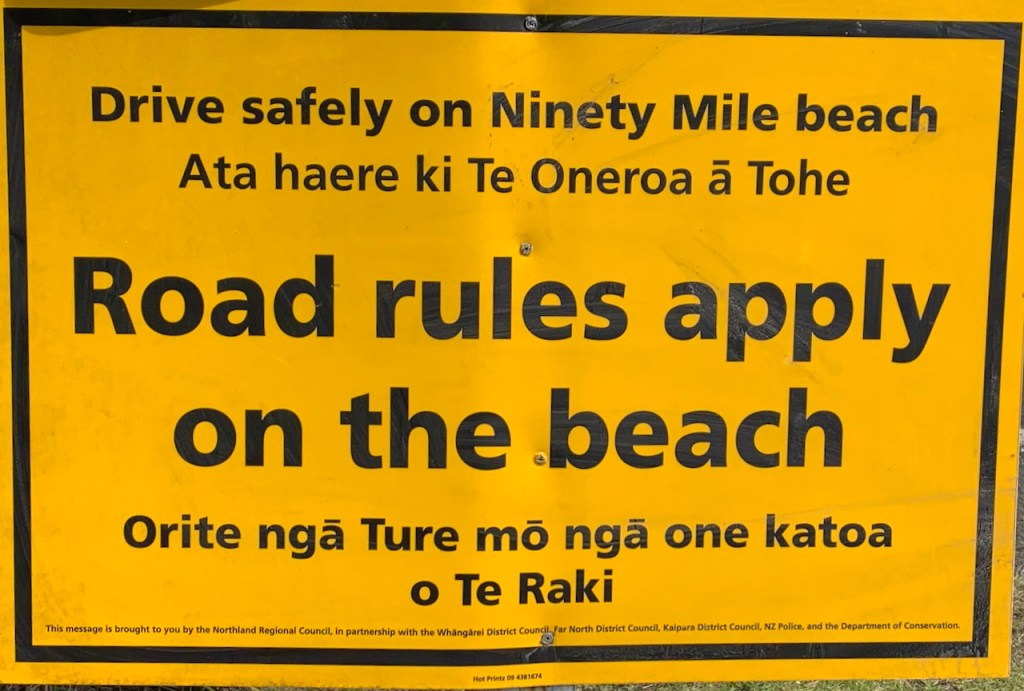
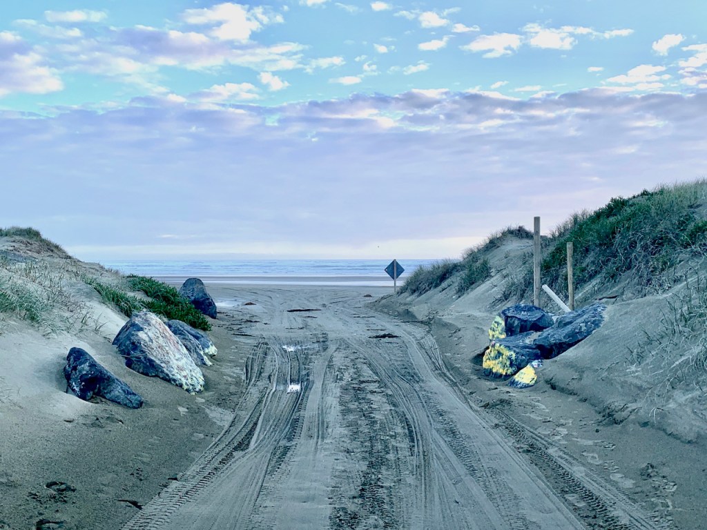
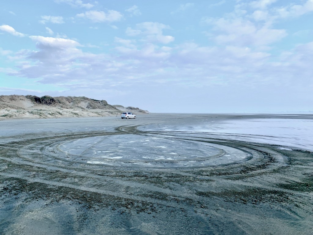
Drivable 90 Mile Beach
Along the west side of the cape is 90 Mile Beach – a beach AND State Road (at low tide). Actual distance, 55 miles. Named by settlers who thought horses could travel 30 miles/day over 3 days, not accounting for slow travel on sand.
Rental car companies prefer you not to drive the motorway. We gave it a go at sundown.
“Fun but dangerous….Beware of“
- High tide
- Quicksand
- Sand holes (hitting one can flip your car)
- Tidal sweeps (waves can advance quickly and catch your car)
- Run-off channels (appear after rain, hitting one can unexpectedly break an axle)
- Slippery plankton build-up (causes loss of control)

Subscribe to receive emails for new posts
To see more North Island – click below:
NORTH ISLAND ARCHIVE

North: Coromandel Seaside
“Good for your Soul” is the tagline for The Coromandel Region where Kiwis holiday. Two coastlines with mountain ranges and forest in-between.
Keep reading
Northland: Paihia Day Trips
This post features a massive boulder field (thank you volcano), gallery, parrots, and a bicycle trail (with eye-pecking magpies).
Keep reading
Northland: Paihia, Opua, Russell, Kerikeri
Northland – SO MUCH sensory overload. It takes me by surprise at every turn – and there are a lot of turns!
Keep reading
Northland: Paihia-Waitangi Treaty
New Zealand was transformed from an exclusively Māori world into one of European domination. The story is told at The Waitangi Treaty Grounds in the…
Keep readingSomething went wrong. Please refresh the page and/or try again.
Click bullets to view our other destinations
Discover more from Travel Broadly - Marlene & Steve
Subscribe to get the latest posts sent to your email.

Stunning photos – eye candy for the soul. Not sure that even makes sense, but who cares??? Lovely!
LikeLiked by 1 person
Love all these pictures!!! Keep enjoying and sharing with us all!!!
LikeLiked by 1 person