Gran Canaria: Mild weather in January, beaches of all kinds, world-class resorts, hiking, surfing, canyoning, even an iron-man camp. We loved the rugged mountains and plunging coastal/canyon roads – this post focuses on sightseeing via car. (Get a guidebook – there’s so much to see!)

Contents
Overview
The southwest part of the island covers 46% of the area, yet 98% of the population resides in the north: 400,000 in Las Palmas, 100,000 in Telde, and 40,000 in Arucas.
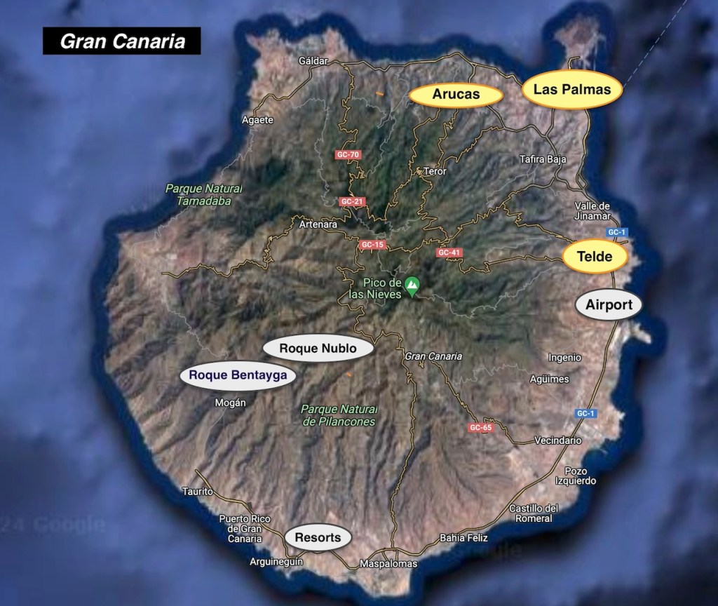
The roads and signage are good. The Ring Road covers 75% of the perimeter from the northwest, the eastside, to the southwest. The west and interior consist of narrow, vertiginous roads winding through deep ravines.
North Route
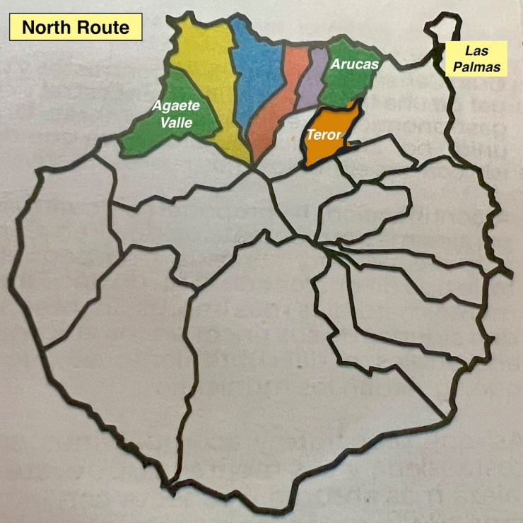
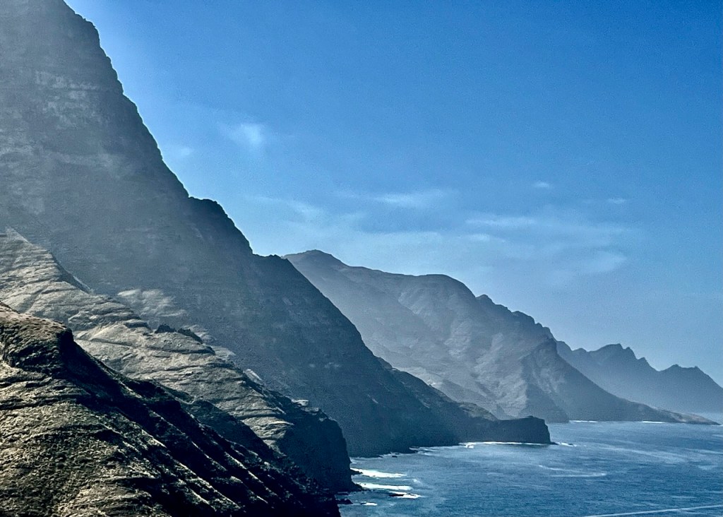
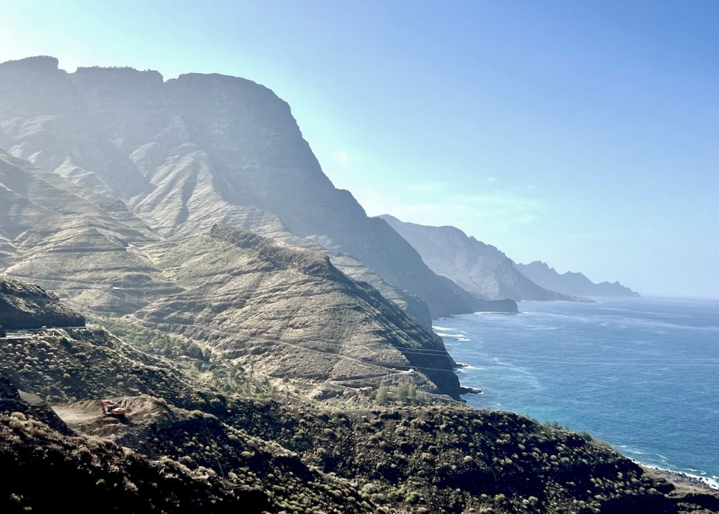
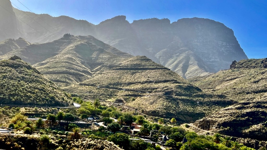
From Las Palmas to the Agaete Valley, the north has the steepest roads with abrupt, rugged mountains, remote beaches and natural pools. Head to the villages, stop at the miradors (lookouts).
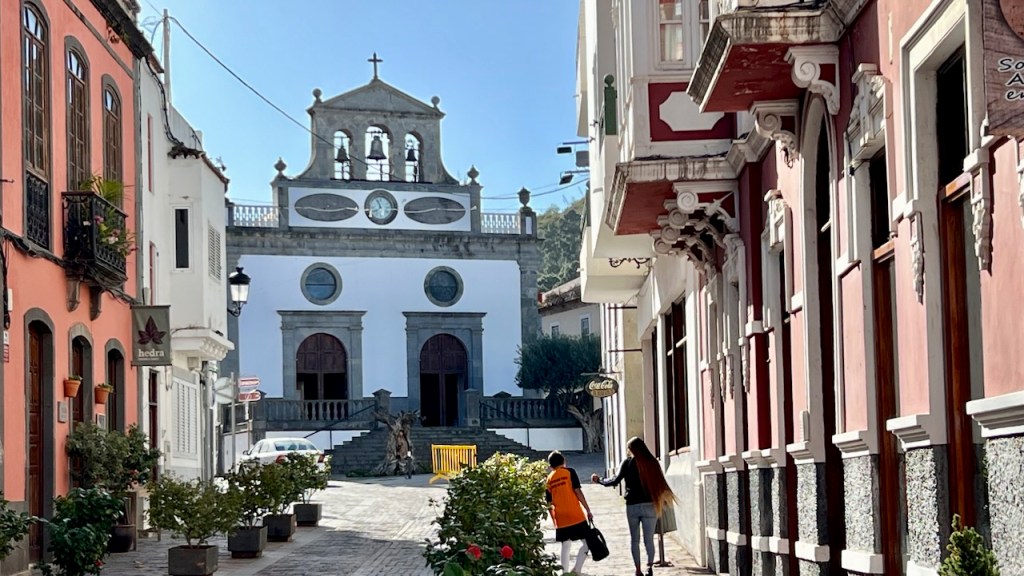
Arucas is coastal and hilly. Don’t miss the iconic church and the excellent Arehucas Rum Factory.

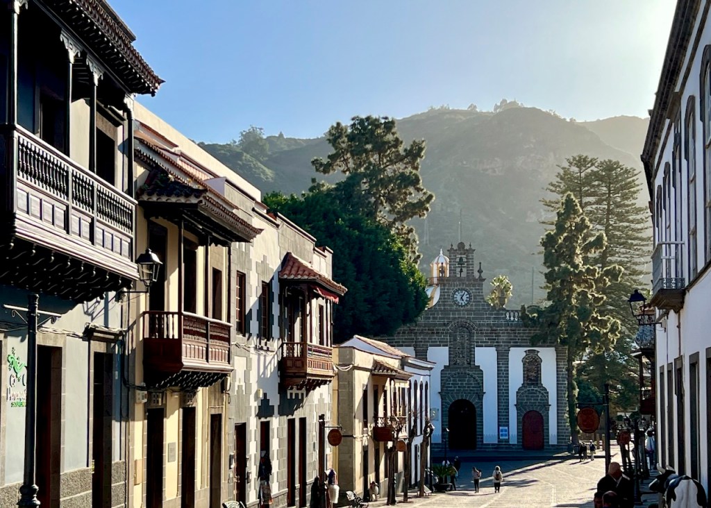
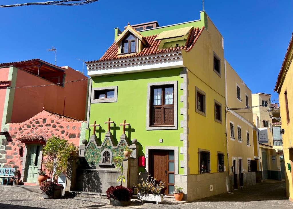
Teror (also accessible via interior routes) has typical Canaria balconies.
Interior Route
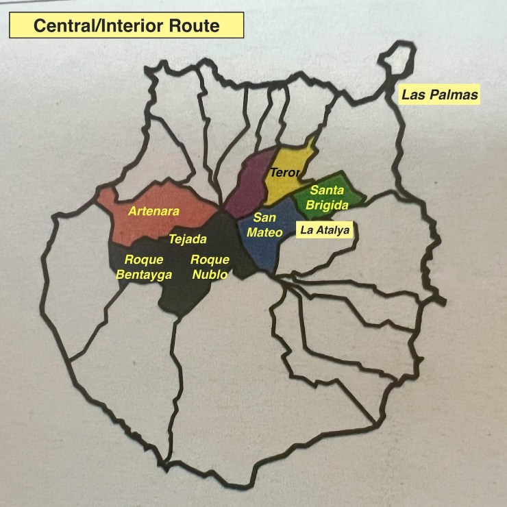
The lesser-known interior holds sacred sites of the indigenous Guanche people.
Driving from Las Palmas to Cruz de Tejada is 33 miles via GC-5, stopping in Santa Brigada, La Atayla, and San Mateo.
The Villages – Rural Heritage
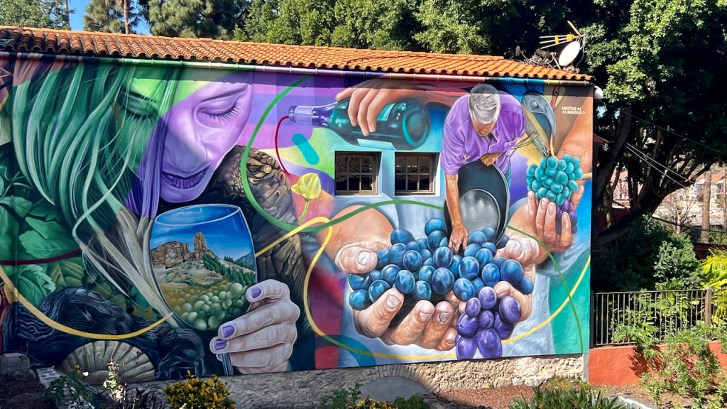
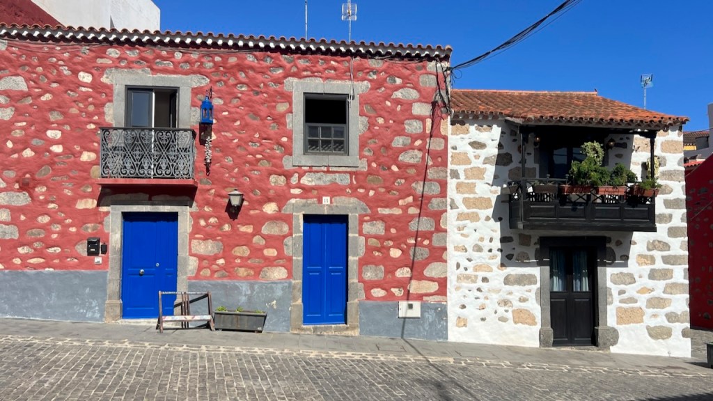
Santa Brigada marks the wine region and San Mateo the agriculture center. Their dwellings retain traditional Canarian features.

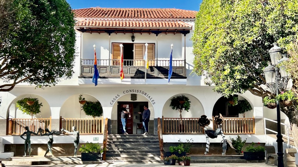
Vega de San Mateo: Alameda de Santa Ana, and the neo-Canarian town hall.
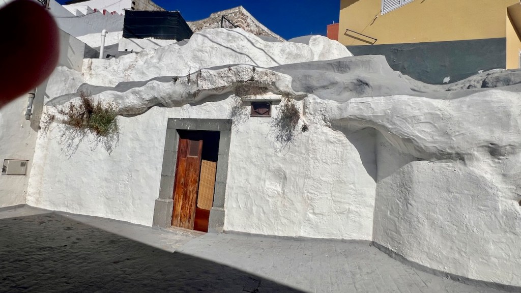
La Atalaya retains its indigenous culture. Many homes are carved into volcanic rock dating to cultures of the Guanche era.
Gateway to Montañas Sagradas
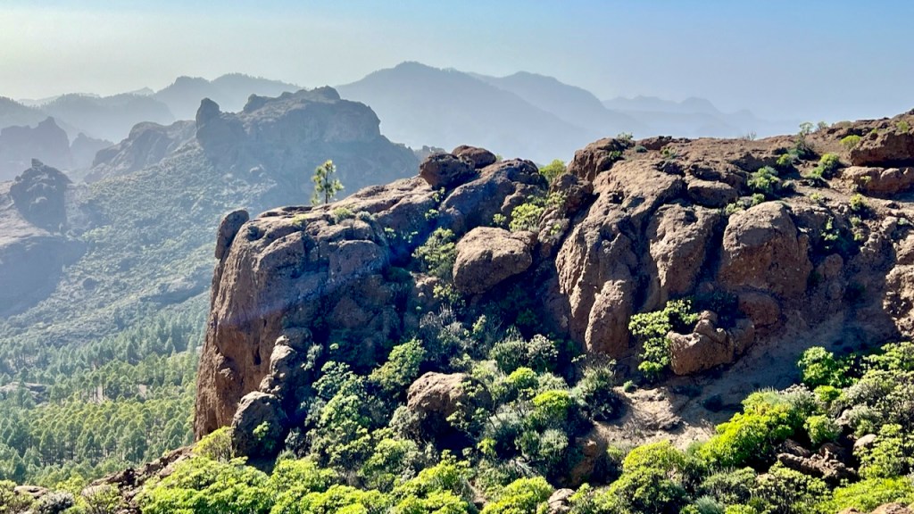
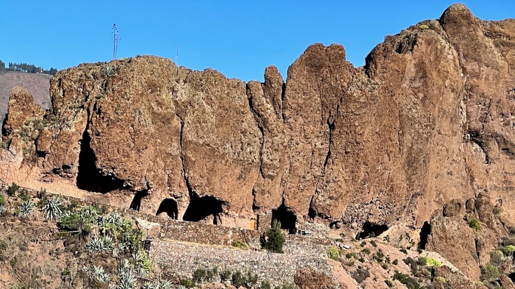
At the geographic center of the island is Cruz de Tejada, a mountain area at 1,560 meters (5,118 feet), the namesake cross a meeting point for shepherds and traders. It is the gateway to Montañas Sagradas (Sacred Mountains), a UNESCO World Heritage Site.
Montañas Sagradas is an archaeological site vital to the aboriginal Canarian culture. There are any remains of cliff dwellings amidst cliffs and volcanic formations.


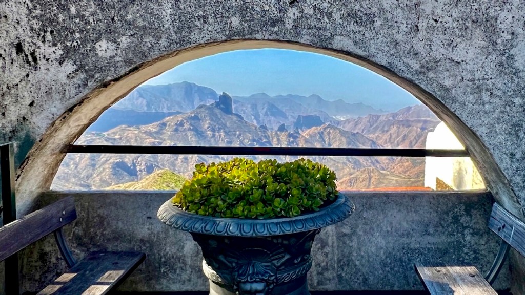
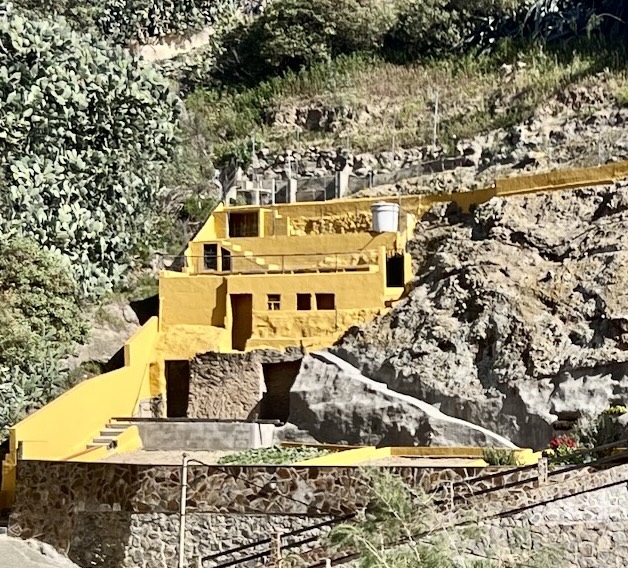
Tip: The Parador de Cruz de Tejada , a hotel with view, spa, hikes. Exceptional stopover.
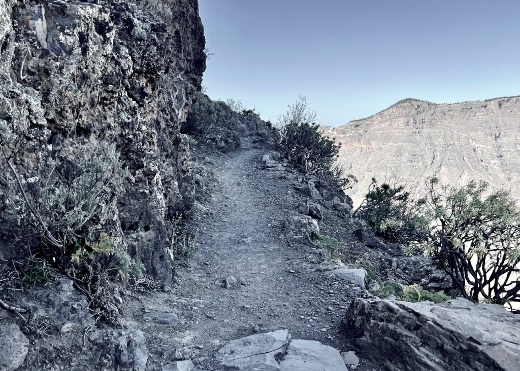
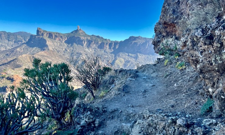
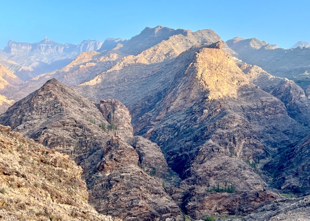
Hiking Two Giants
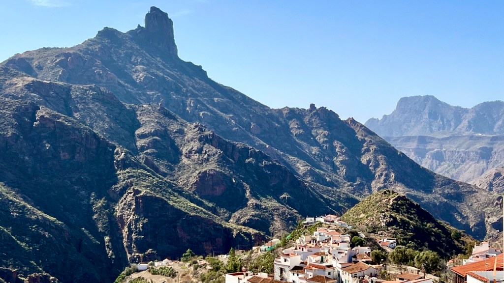
Two of area’s giant volcanic formations are Roques Nublo and Bentayga.
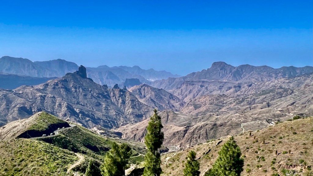
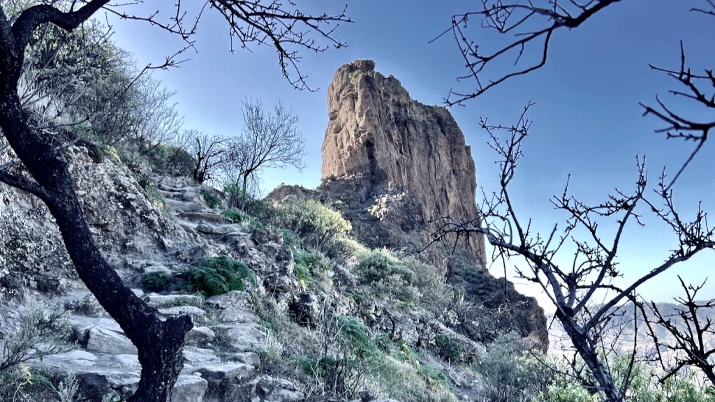
Roque Nublo: 20 minutes from Cruz de Tejada (GC-150, GC-600), 1,813 meters (5,948 feet).
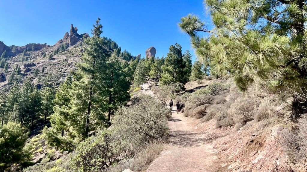


Another day we drove to Roque Bentayga, which towers over the beautiful village of Tejada. From Cruz de Tejada, it is a short drive to Tejada (GC-15), then a 30-minute drive (GC-60) up to Bentayga. A short trail climbs to the “Almogarén,” an ancient place of worship.
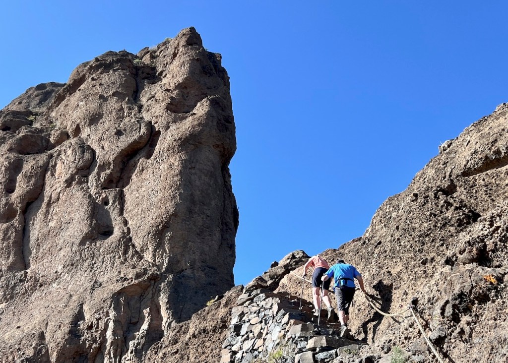
The Roque Bantayga Interpretive Center provides insights into the area’s pre-Hispanic cave dwellings.
Wrong Turn – Best Day Ever!
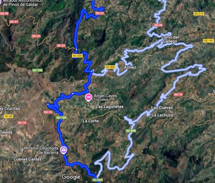
At dusk, we mistakenly turned onto a narrow road atop deep ravines. Determined not to turn back, we followed a faint line on the map for two hours back “home”.
Serpentine!
One may think “if you’ve seen one ravine (with the road crumbling at the sides) you’ve seen them all”, but not me!
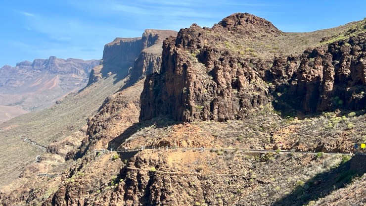

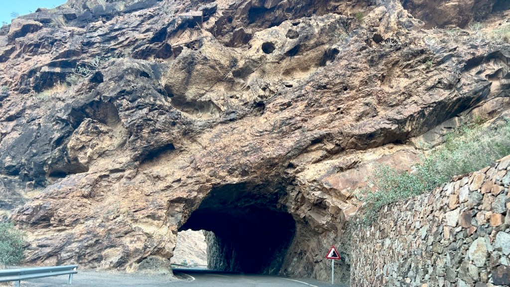
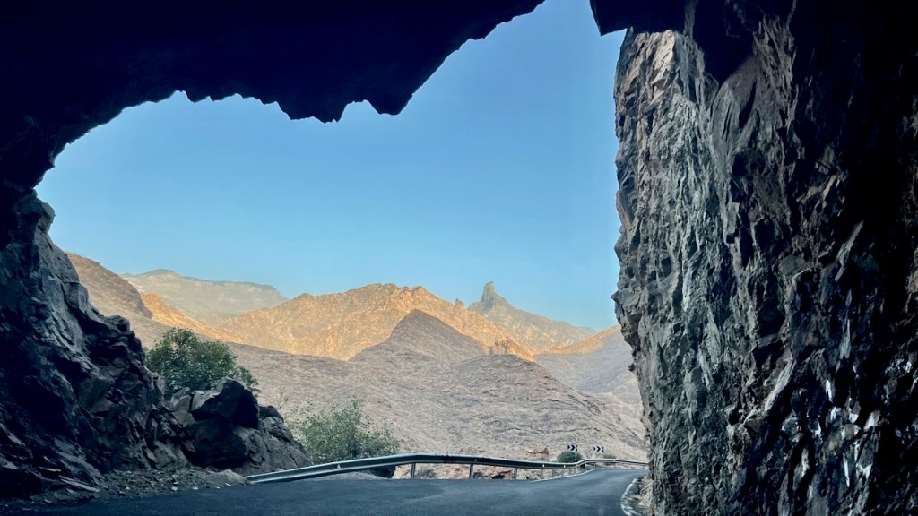
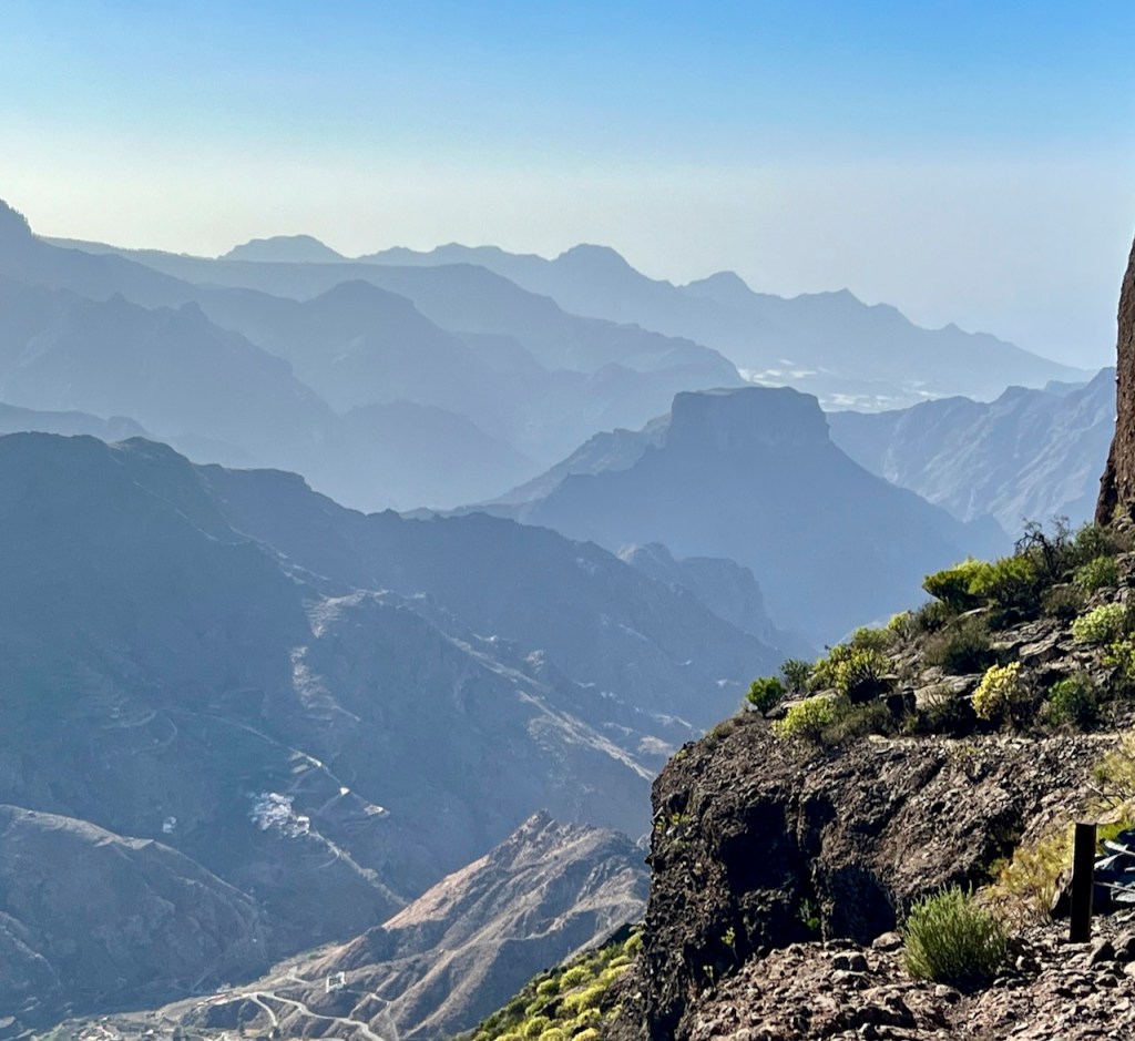
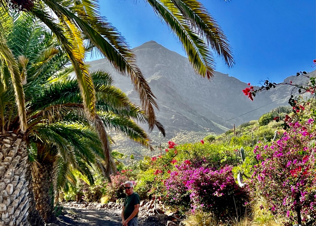
Southwest Route

GC-200 is a challenging, scenic route with 365 curves and hairpin bends. Sheer cliff drops at elevations of 200-900 meters. (www.dangerousroads.com)
This region is 90% protected land, desert ravines lead to pristine beaches and oases of palm and pine trees.
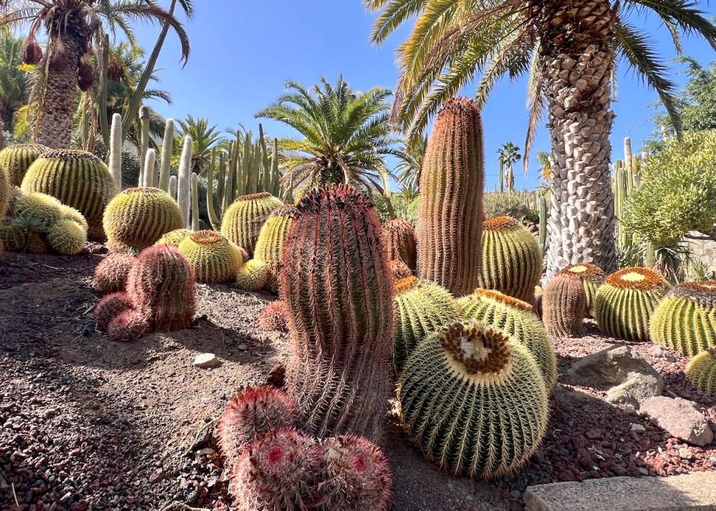
La Aldea, Cactualdea Park, over 1,200 cactus species from around the world.

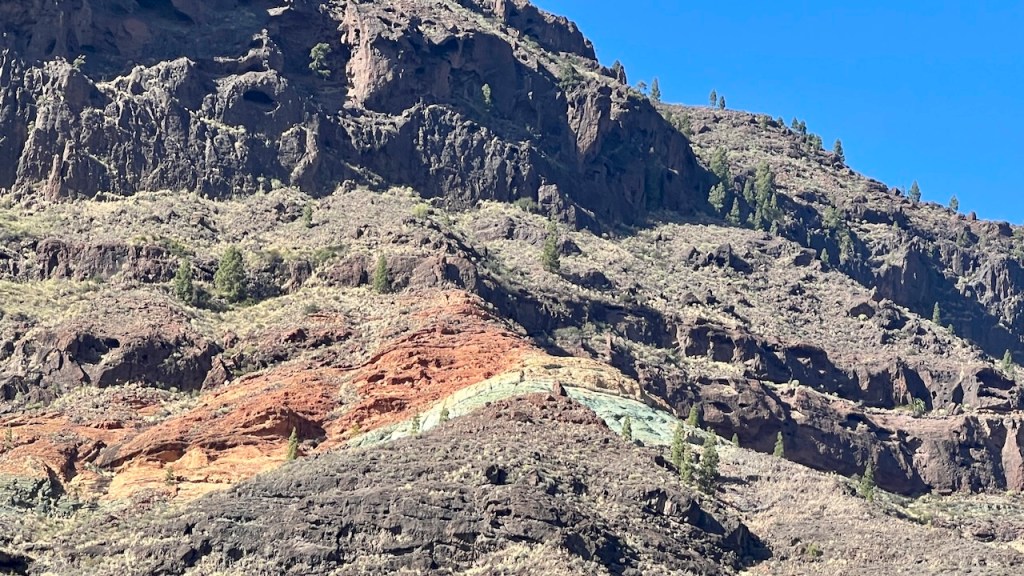
Los Azulejos de Veneguera (Rainbow Rocks)


Where Most Tourists Stay
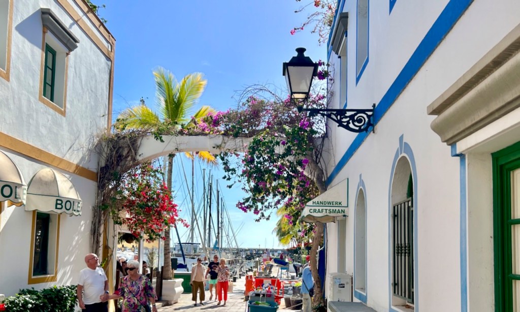
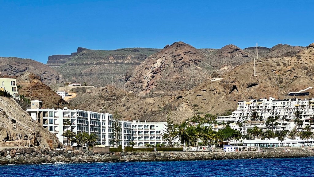
Resort on the south end vary from boutique hotels in Puerto de Mogán to large seaside coastal hotels.
East Route
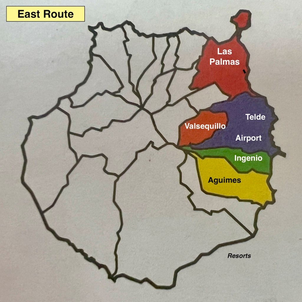
Las Palmas was our base, a great choice. However, we spent little time exploring the east side, missing:
- Telde, an aboriginal kingdom;
- Valsequelllo, volcanic craters;
- Agüimes, colorful houses, Barranco de Las Vacas (canyon);
- Maspalomas Dunes
Las Palmas
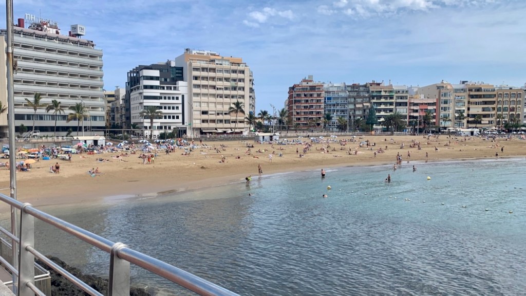
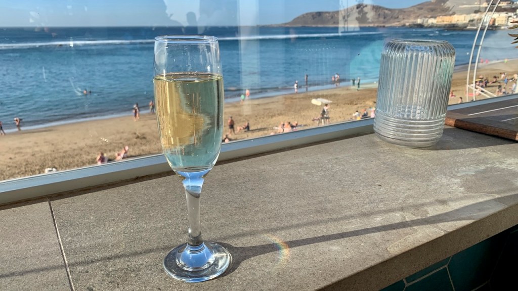
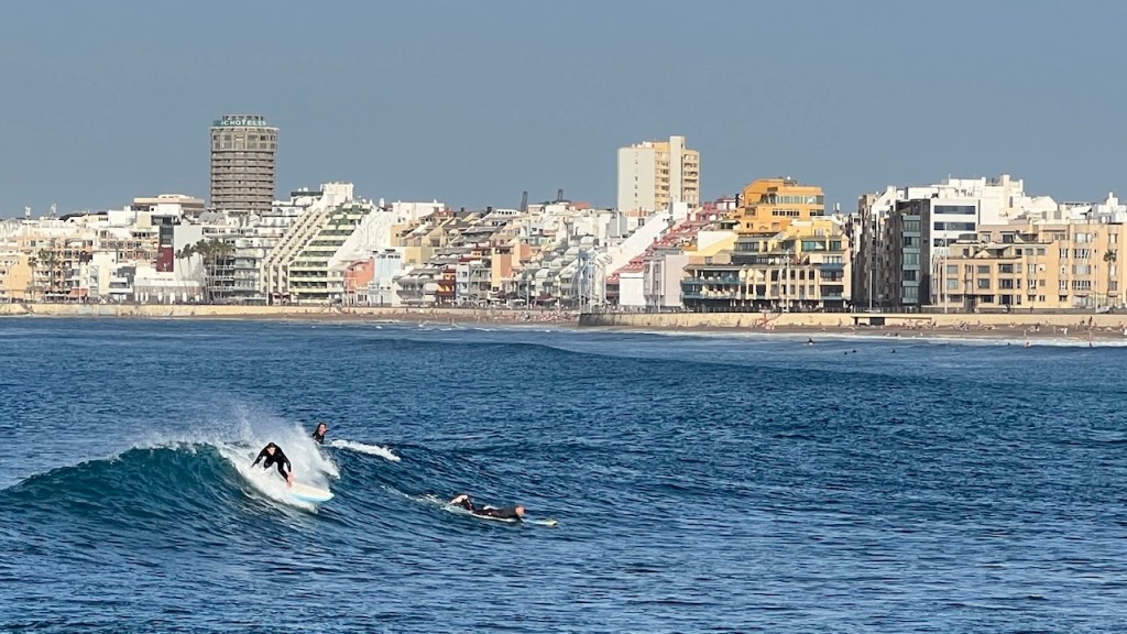
We spent 3 weeks in an apartment near Las Palmas’ city-center beach, Las Canteras, 3 km of golden sand, free from loud music, smoking, and litter. (There’s a sign . . . it is enforced).
Alongside is a promenade with cafes, shops, and sunset bars with a perfect view. A pleasant one hour, end-to-end, walk.
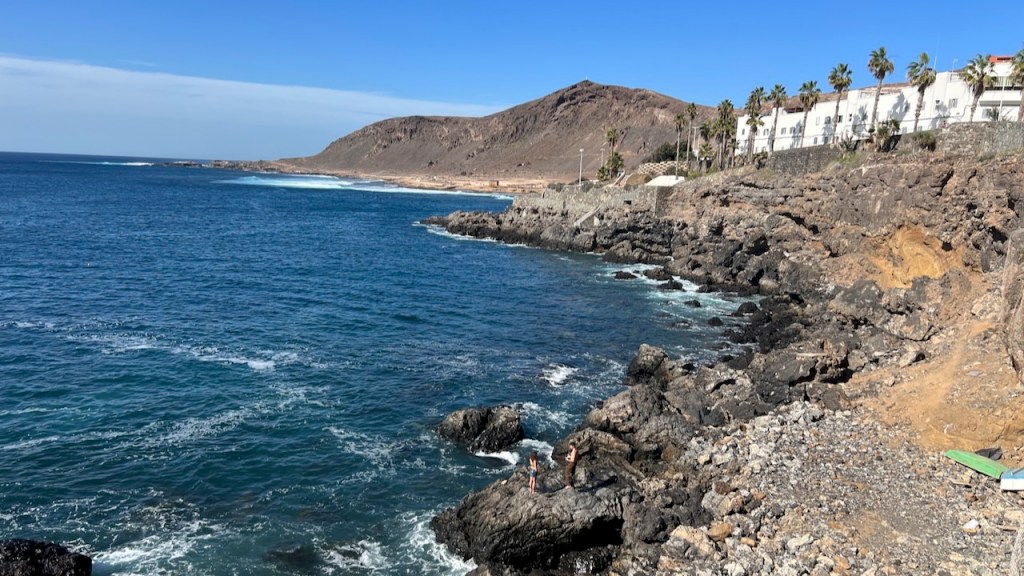
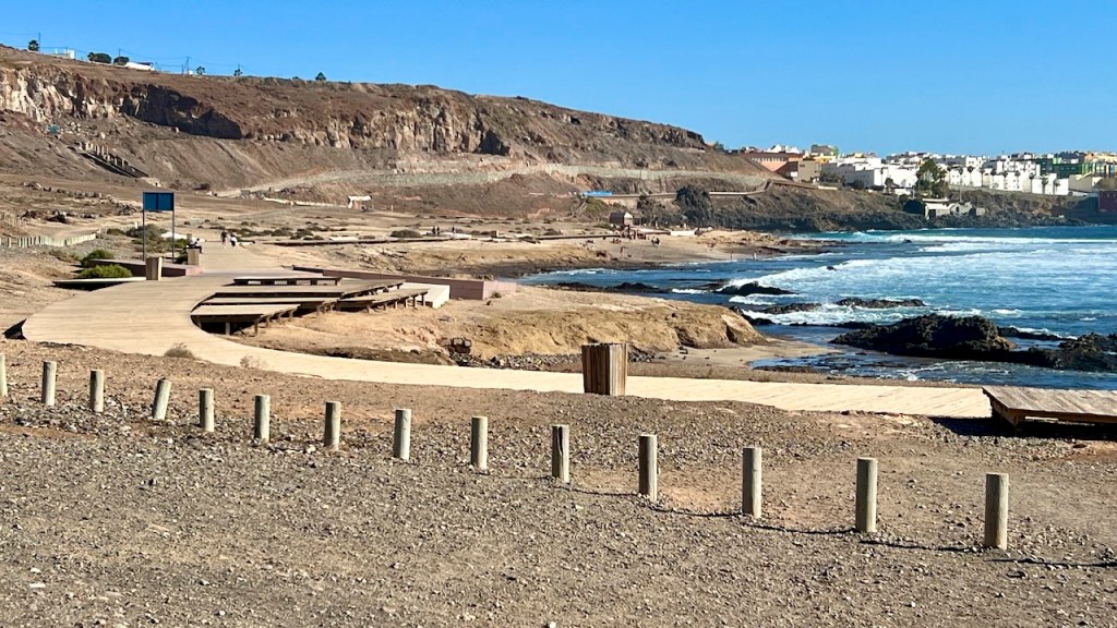
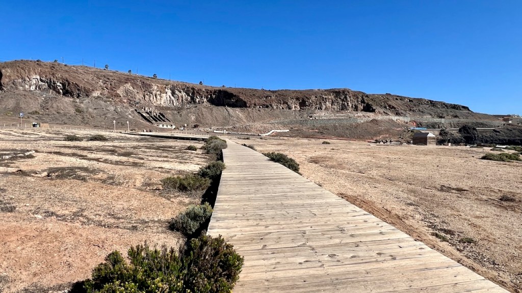
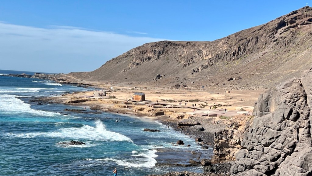
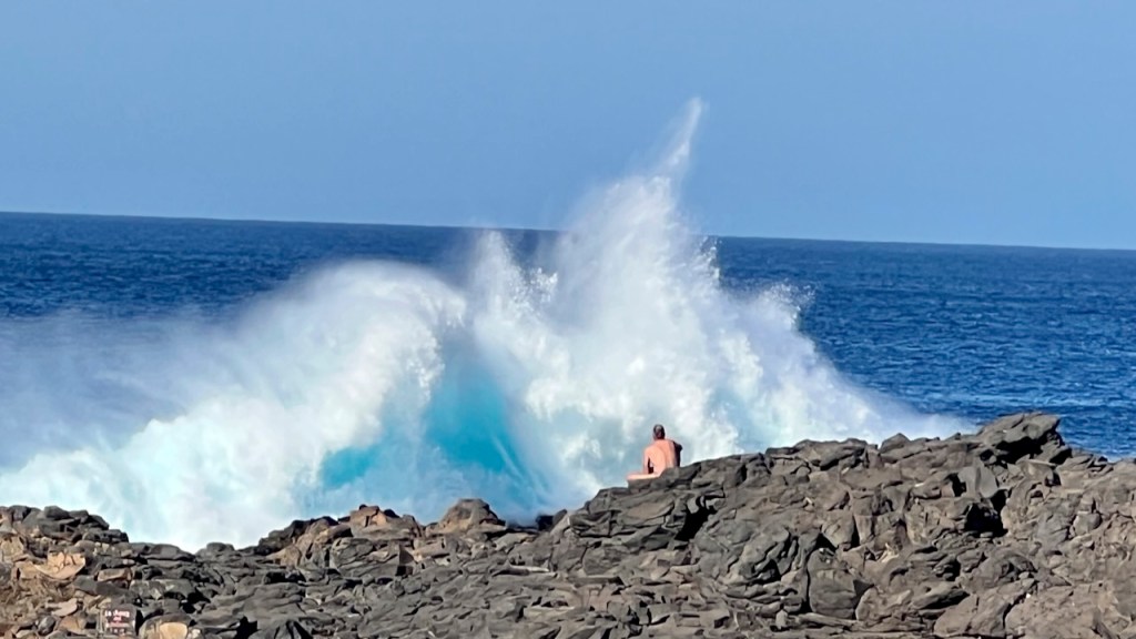
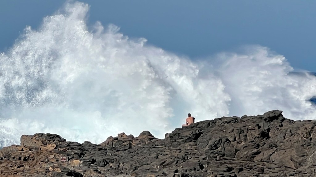
Hike further to El Cofital Nature Reserve and around the headland to Morro del Pulpo. Continue right for a steep climb to Barrio de las Coloradas.
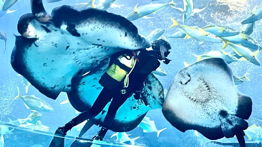
Poema del Mar (aquarium) – See giant rays and a sea turtle with prosthetic flippers.


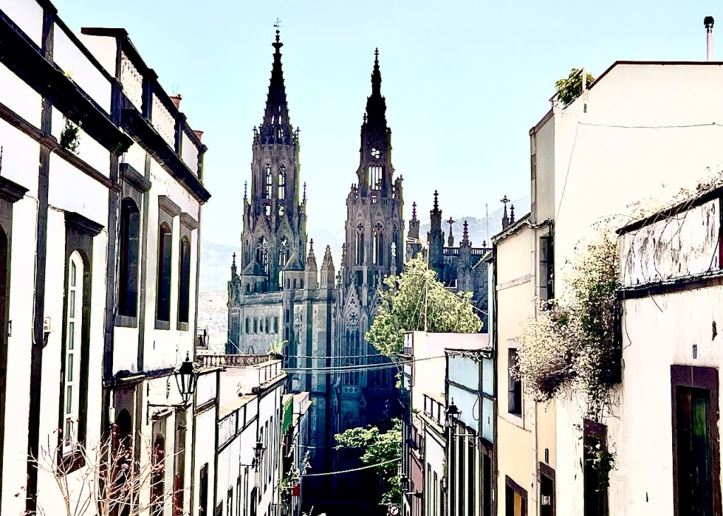
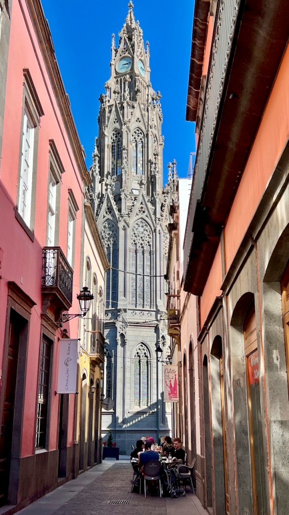
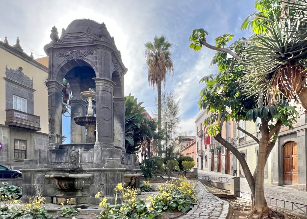
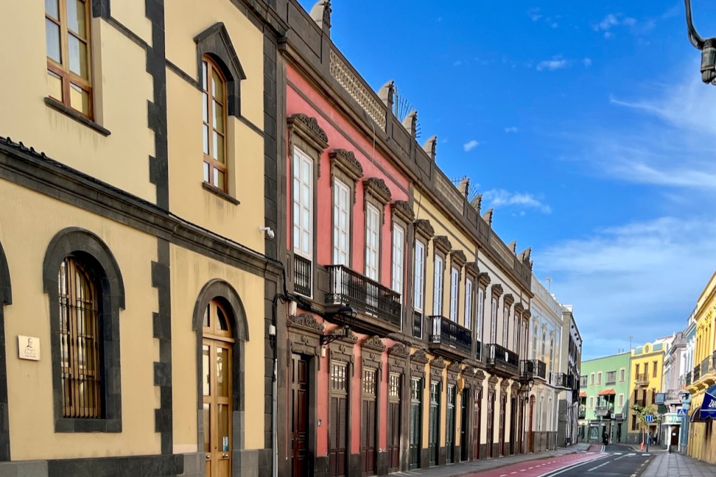
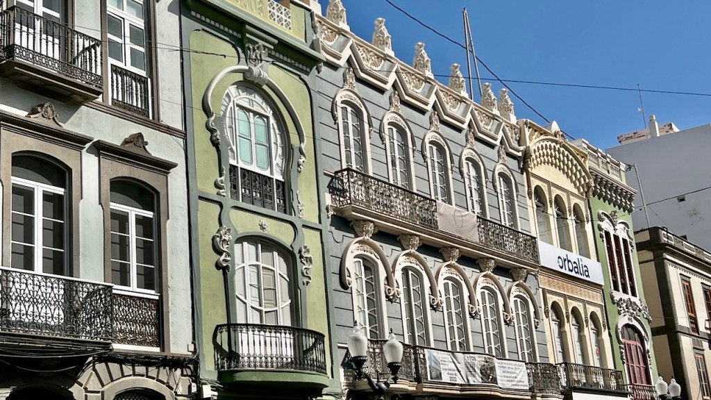
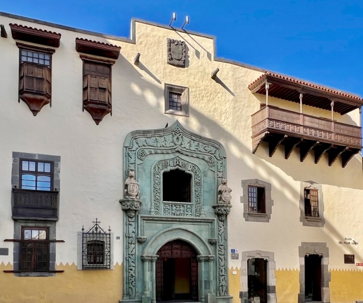
Old Town Landmarks
Vegueta and Colonial Triana are a quick taxi ride south of Las Canteras.
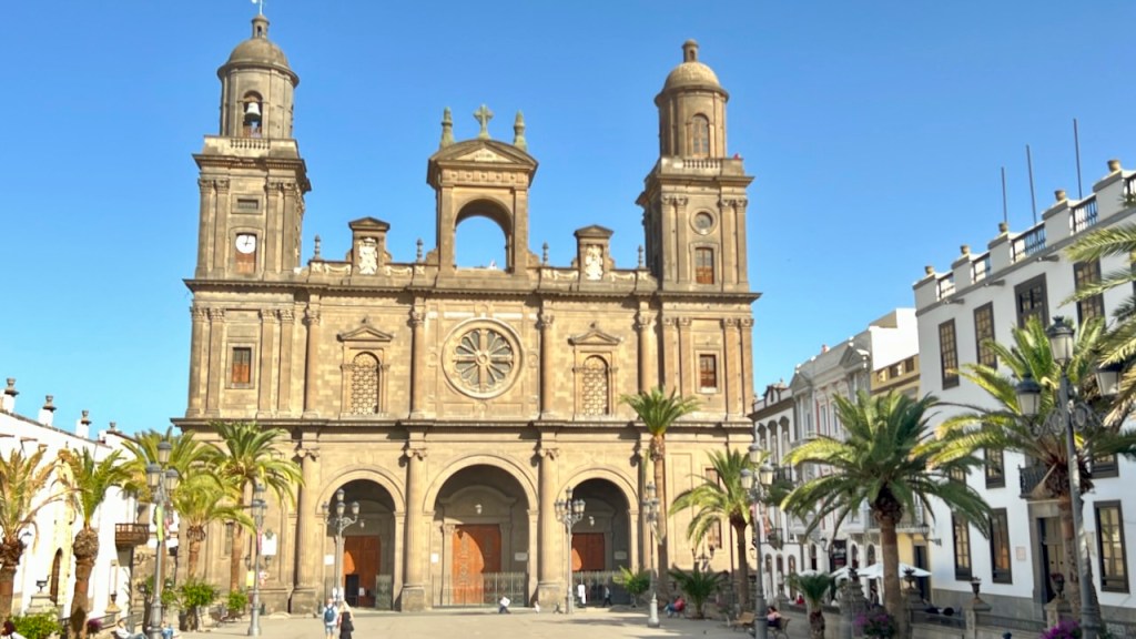
- Cathedral de Santa Ana
- Espiritu Santo Plaza
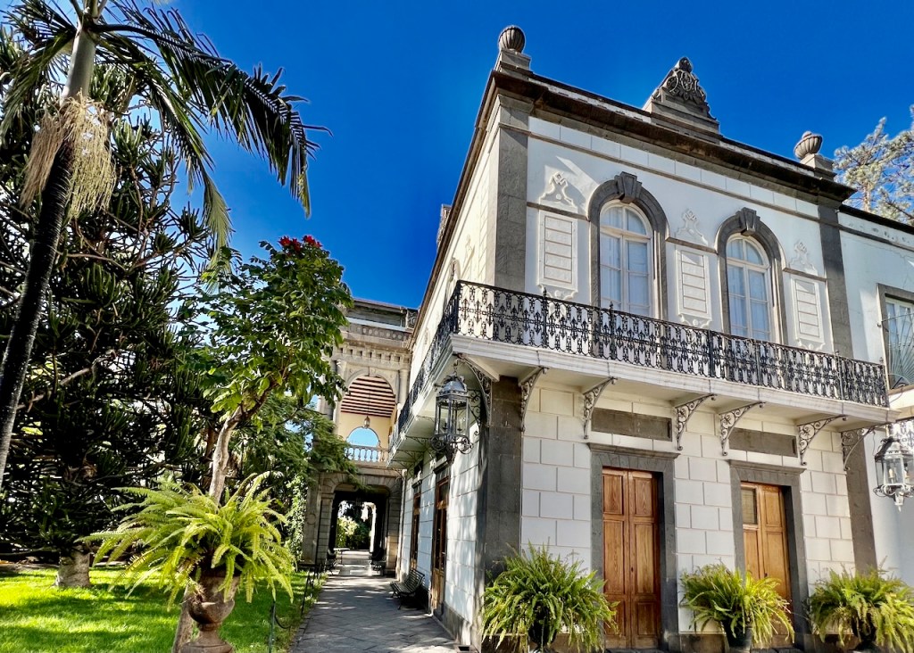
- Casa de Colón (Christopher Columbus Museum)
- Calle Mendizábel (cafes)
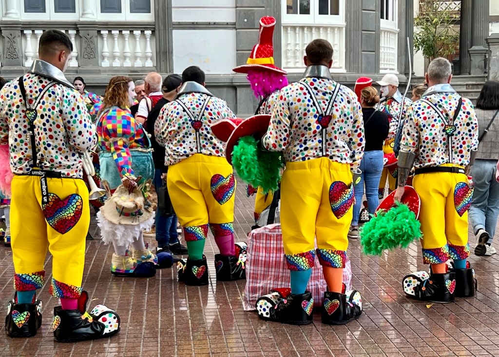
And the Most Fun – People Watching
In January, 2024, our trip was the week before Carnival . . . music, dancing and singing in the streets.
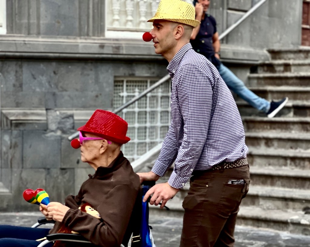
Clown spectacle in old town


Dancing on the Promenade – Carnival Style
Traditional Folk Dancing
Gran Canaria was wonderful. We hope we can return to appreciate the rich culture.
See related Canary Islands posts.
Subscribe for new stories via email. (No ads!)
Discover more from Travel Broadly - Marlene & Steve
Subscribe to get the latest posts sent to your email.

What a gem – both the island and your super well-organized and interesting travel guide. Photos are superb!
LikeLike