Zion National Park
Pink, orange, crimson, white, and gray formations (did Disney build this?) hiking trails for all skill levels, and those 2,000 foot walls. The park is radically diverse in all directions.
Named Mukuntuweap, Paiute word for straight-up walls, the Mormon community called it Zion, heavenly kingdom. A Methodist preacher added names such as Great White Throne, Angels Landing, and The Watchman to the formations.
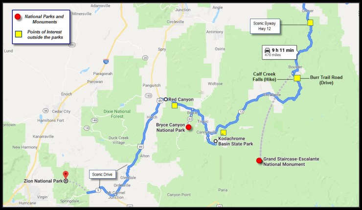
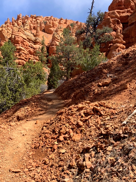
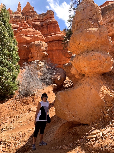
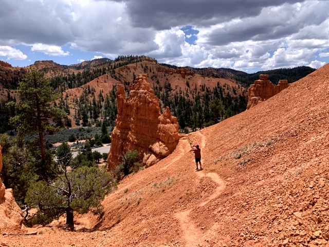
First, a surprise! Red Canyon, “The most photographed spot in Utah”
Driving west to Zion on Scenic Byway UT 12, we found quintessential Utah in Red Canyon, in the Dixie National Forest. The ledges, hoodoos and turrets were pink and orange, the soil red.


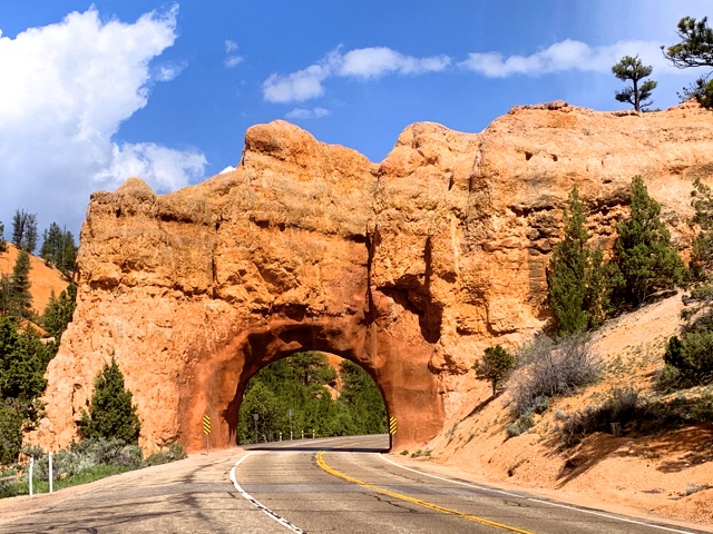
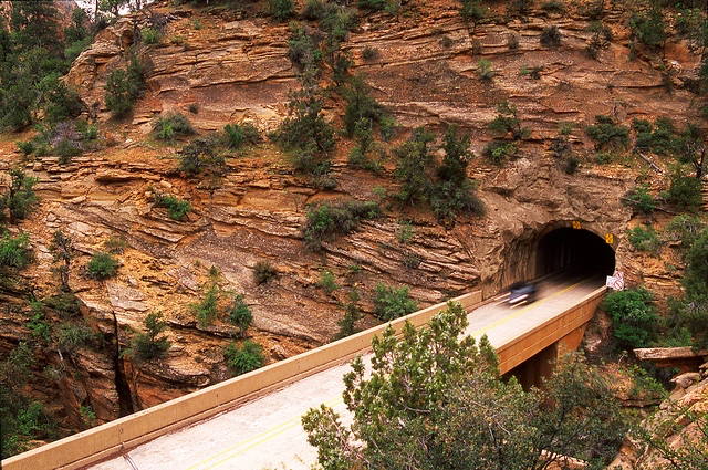
Tunnel west of Red Canyon
Zion – Holy Moly!
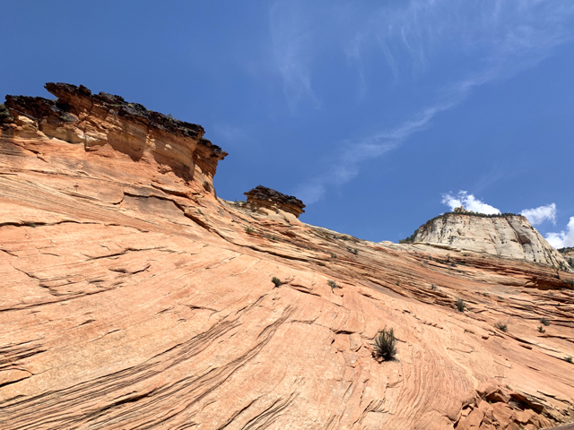
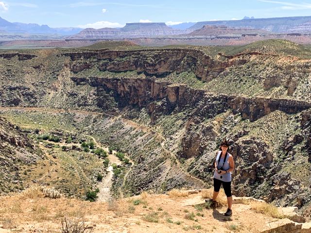
East Zion:
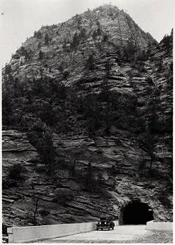
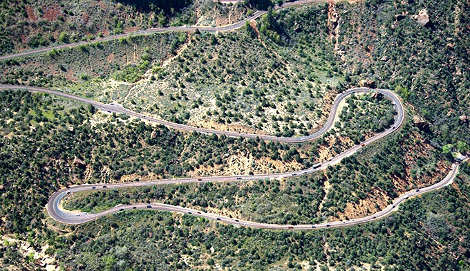
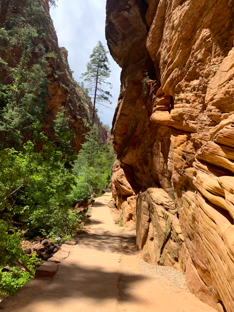
Zion Mt. Carmel Highway (SR 9) is a postcard of a drive – narrow tunnels, switchbacks, and dropoffs.
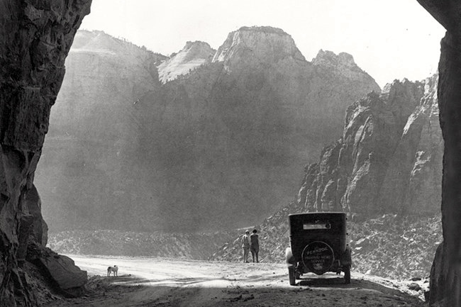
The Zion Mt Carmel Tunnel, 1.1 miles long was built in the early 1900’s. Imagine cutting and blasting through sandstone 2,000 feet thick with an 800 foot drop-off at your side.

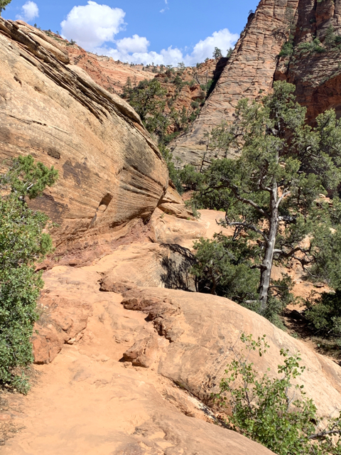
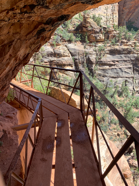
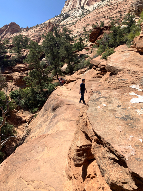
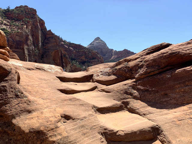
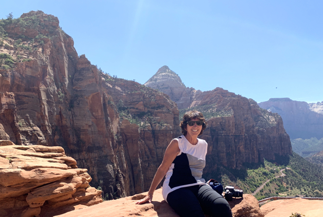
Before the tunnel is Canyon Overlook Trail, a very fun hike that heads to high views of Zion Canyon.
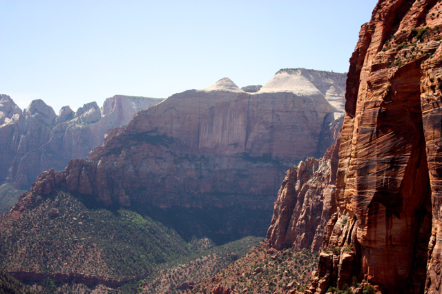
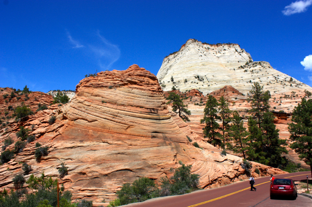
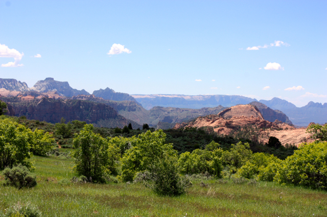
Beyond the tunnel are giant sculpted sandstone mounds and mesas, drastically different from south and north Zion.

Throughout the park, The Virgin River was running fast from spring snowmelt. What We Learned:
- The flow of the Virgin River measured in cubic feet per second (CFS) determines the open/closed status of various Zion Canyons. During our visit the current ranged from 758 to 430 CFS. The gauge must stay below 120 or 150 CFS for 24 hours before hiking in the canyon trails (e.g. the Narrows) is permitted.
- “If the river is at 40 CFS, about 40 basketballs of water are passing you EVERY second.” (Quote CanyoneeringUSA.com).
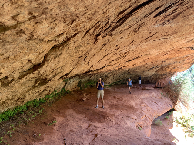
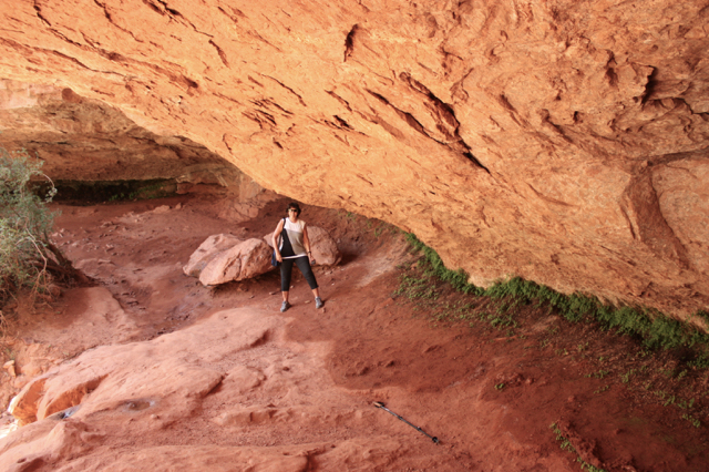
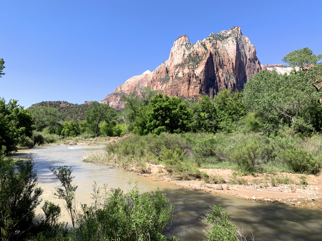
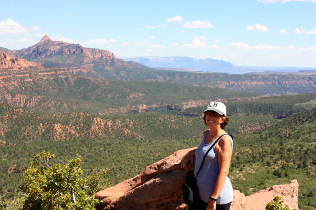
West Zion – Court of the Patriarchs
Court of the Patriarchs is named after Abraham, Issac and Jacob. Here, we hiked Sand Bench Trail, trailed a turkey, and saw porcupine claw marks on the trees.
Sand Bench Trail 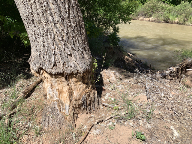
Porcupine Damage 
Three peaks: Abraham, Isaac and Jacob Peaks
South Zion
Due to rockslides only the Lower Trail to the Emerald Pools was accessible.
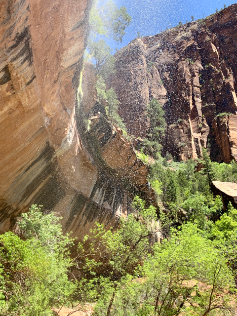
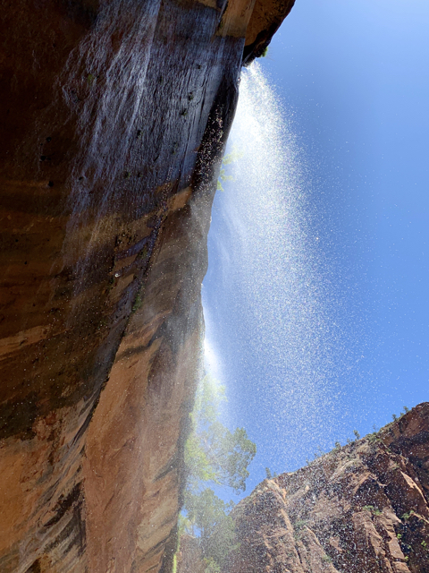
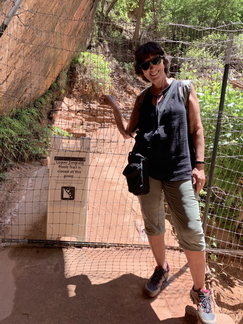
Urge to continue, curtailed 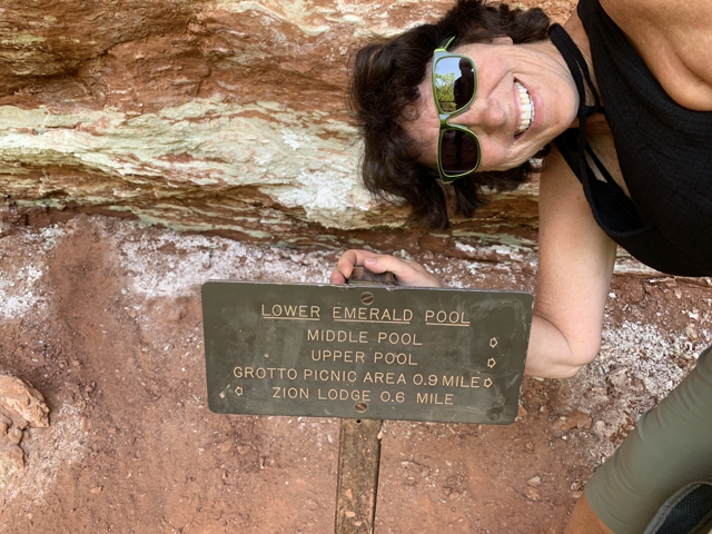

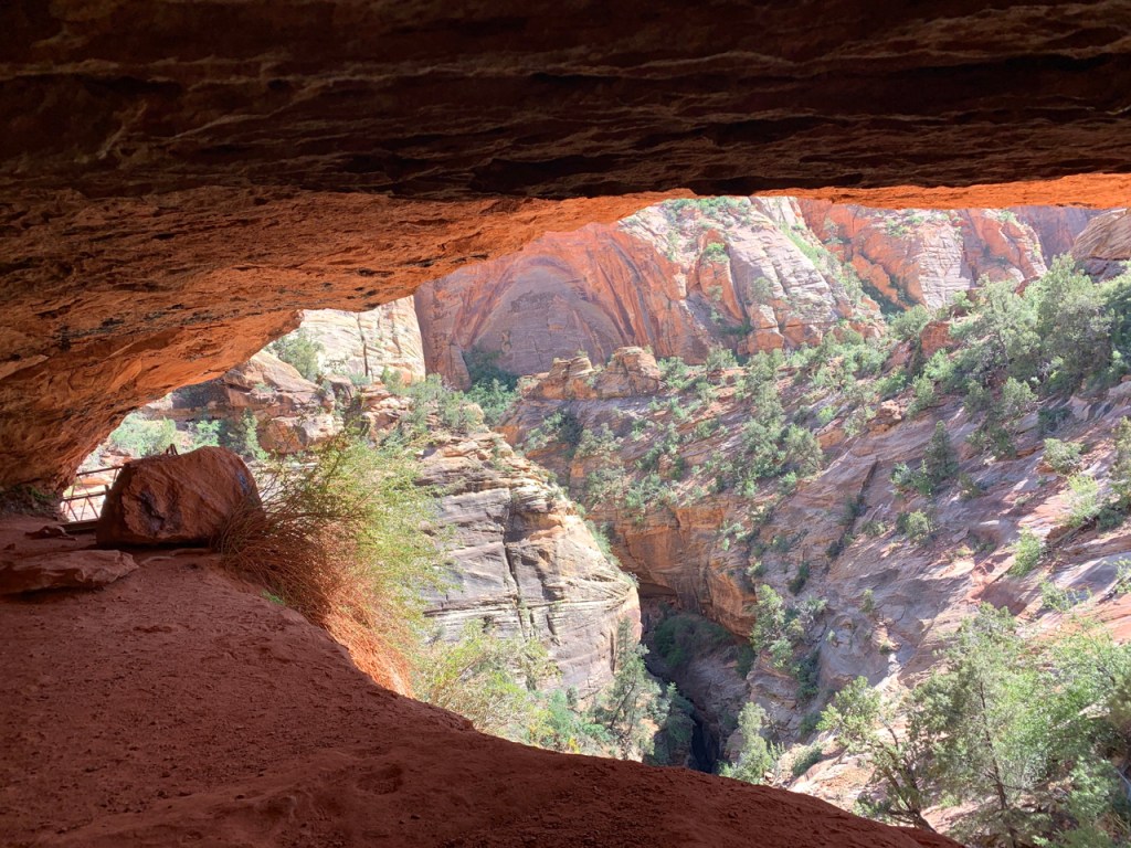
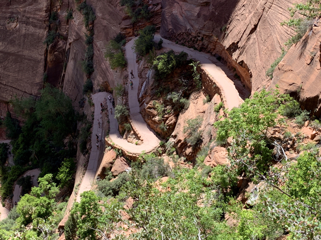
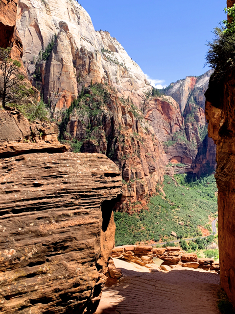
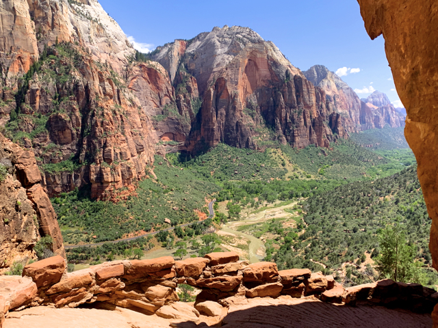
Another closure due to a major rockfall, Hidden Canyon Trail, led us to Angels Landing Trail. (“A classic hike for those who are not afraid of heights” )
The closure of Hidden Canyon meant Angels Landing was extra crowded, with a queue at the chains. This being the 4th hike of a hot day, I turned back before the top. (It is on the “Do Over” list.)


North Zion
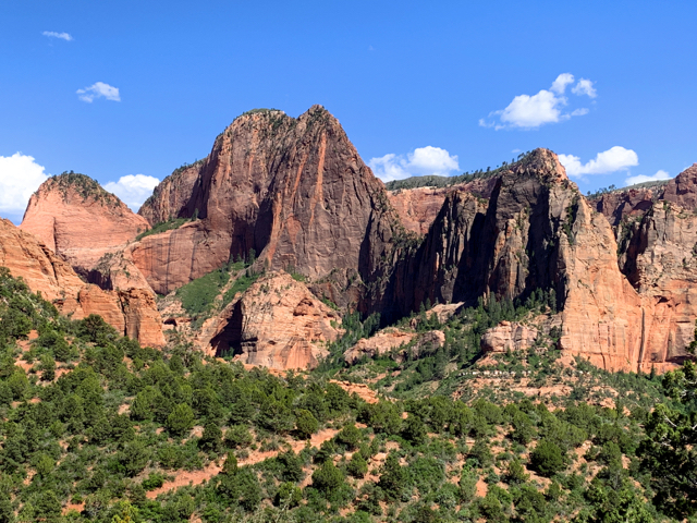
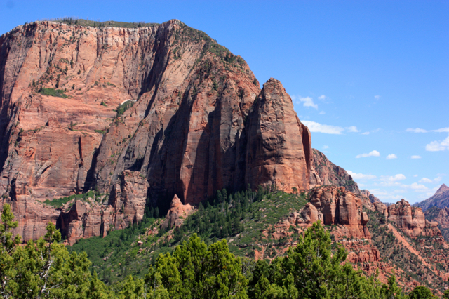
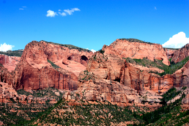
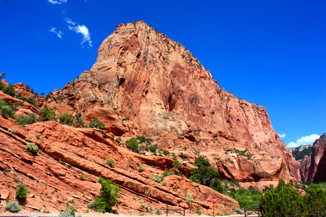
Kolob Canyon and Kolob Terrace – A backcountry hiker’s paradise…for us, a nice drive.
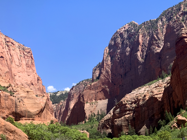
Kolob Canyons is remote backcountry that follows the Hurricane Fault’s tilted rock layers and incredible canyons. The scenic drive ends at the Timber Creek Overlook Trail (and it is cooler up there).
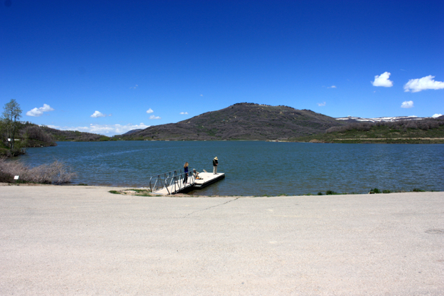
Kolob Terrace runs through ranch land, up a narrow tongue of land (so cool) with dropoffs on either side – the Hurricane Cliffs on one side, the backside of Zion’s big walls on the other. It ends at a reservoir where we watched a bald eagle watch us.

What We Missed and Recommendations
We never made it to the end of the park – to Big Bend, Temple of Sinawavam, or Riverside Walk, so we missed “2000 foot tall rock walls that reach up from the Virgin River.”
The Narrows – “A stunning gorge/crack in the earth“, was closed. The current measured a flow of 450 CFS, and water in The Narrows was chest/neck high. Per a chat with Ranger Lee: Anytime the current in The Narrows is above 70 CFS there are areas of water reaching mid-thigh and pools can be chest deep. The river bottom is slippery and uneven (like walking on bocci balls.)
Hidden Canyon Trail – Description: The high walls, rarely more than 65 feet apart, block sunlight except for a short time at midday….Footing can be a bit difficult in places, but chains provide handholds on the exposed sections. How can you NOT want to do that?
Thank you for following us!
Subscribe to receive emails for new posts
Click bullets to view our other destinations
Discover more from Travel Broadly - Marlene & Steve
Subscribe to get the latest posts sent to your email.

Zion was my favorite too! I held on to the chains at Angel’s Landing with a death grip. I was fortunate to do part of the narrows; water was knee to thigh high. I can’t fathom doing it higher. Love your posts!
LikeLike
So enjoyed this post.
Thanks for letting me tag along.
Donna
LikeLike
We did Angels landing to the top where you climb chains to reach the peak. In Sept, when we were there, most everyone we met on the trail was from Europe. It seemed most Americans preferred to just look up. We also did the Narrows, where you have to cross over the riverbank & at many spots. You need hiking shoes & a long stick that they left at the entrance for hikers. We were lucky to find a day without rain, as it is closed for any amt. of precipitation. On a second trip to Zion the Narrows were closed. Denny & Sharon
LikeLike